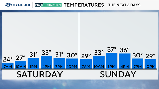
Partly cloudy, chilly Saturday as temperatures continue to linger below freezing. Here's the forecast.
Cold weather remains the story in the Philadelphia area this weekend, so the layering needs to continue, especially if you're spending time outside. Cleaning up decorations, tailgating at the Linc, Getting in some New Year exercise, etc. all time periods will have wind chill temps below freezing.
It's the hats, gloves and heavy coats. If traveling late Saturday night you may encounter a few snow showers, otherwise the weekend is trending dry.
NEXT big weather change
The cold trend will continue through the weekend with high temperatures remaining in the mid-upper 30s and low temperatures in the low-middle 20s.
Next week will start off chilly with 20s in the morning and highs in the middle 30s, but the 40s will return by Tuesday.
In fact, a warmer trend looks to lead us through the majority of next week with high temperatures running near or even slightly warmer than normal. High temperatures next Wednesday and Thursday may be into the low 50s with overnight lows actually staying above Freezing.
Precip chances arrive Tuesday in the form of rain that will last into the overnight hours and early Wed. Then again on Friday. longer-term forecast (8-14 days) has a chance for more above normal temps, meaning our cold pattern will likely be shifting. It also means the snow chances will decrease a bit with precipitation chances in the form of rain increasing.
Here's your 7-day forecast:
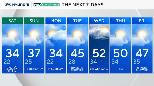
Saturday: Partly cloudy and chilly. High 34, Low 22
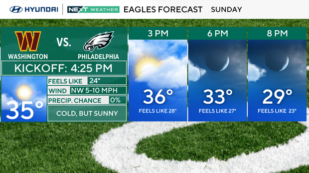
Sunday: Mostly sunny. High 37, Low 25
Monday: Still chilly. High 34, Low 22
Tuesday: Tracking showers. High 45, Low 28
Wednesday: Shower early. High 50, Low 34
Thursday: Mild. High 47, Low 35
Friday: Chance showeers. High 47, Low 35