Fall begins Tuesday with crisp, cool temperatures in Philadelphia region. Here's the weather forecast.
Fall officially arrives tonight at 8:05 p.m., and the weather is getting a head start. Temperatures won't move much through the day. Expect highs only in the mid 60s, roughly 10 to 15 degrees cooler than normal.
The steadiest rain is tapering, but the umbrella is definitely the more useful accessory than the sunglasses today. Rain becomes more scattered later this afternoon and should gradually taper toward evening.
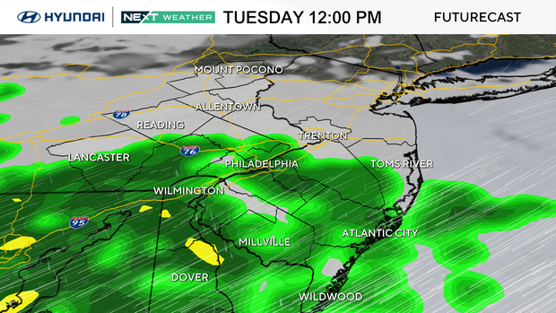
It will also be breezy and raw, with northeast winds gusting around 20 to 25 mph at times. If you're heading outside for lunch, errands or after-school activities, this is a light-jacket-and-umbrella day. Outdoor sports may be playable later today as the steadier rain exits, but fields will obviously be wet.
At the shore, the persistent northeast wind is the bigger concern. Water will continue piling toward the coast, increasing the threat for tidal flooding along with rough surf and beach erosion.
NEXT big weather changes
The rain becomes less widespread after today, but we are not flipping back to sunshine.
The front responsible for today's rain gets pushed south Wednesday, allowing the steadiest precipitation to move away. A little rain may linger Wednesday morning, followed by a mostly cloudy, breezy afternoon with highs only in the upper 60s.
Thursday stays cool and mostly cloudy as strong high pressure to our north maintains an onshore flow. That persistent northeast wind means coastal flooding and rough surf remain concerns through at least the middle and latter part of the week, even during stretches when it isn't raining.
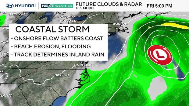
Then our attention turns to a developing coastal low late this week. There is still meaningful uncertainty in exactly where that low develops and how close it tracks to the coast. A farther offshore track would keep the heavier rain mainly east of Philadelphia, while a closer track could bring another period of rain and stronger winds into the region Thursday night through Friday or Saturday.
Either way, the prolonged onshore flow makes the shore particularly vulnerable to additional tidal flooding, rough surf and beach erosion.
The pattern finally looks more encouraging early next week, with a better opportunity for sunshine and temperatures recovering into the 70s.
Here's your 7-day forecast:
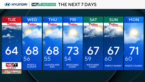
Tuesday: Periods of rain. High 64, Low 60
Wednesday: Mostly cloudy. High 68, Low 56
Thursday: Clouds and sun. High 68, Low 55
Friday: Watching coast. High 73, Low 54
Saturday: Watching coast. High 67, Low 59
Sunday: Partly sunny. High 67, Low 60
Monday: Mostly sunny. High 71, Low 60
Get the latest weather info on the CBS News Philadelphia app.


