Wet winter: What's with all the rain in NYC and around the Tri-State Area?
We are finally drying out after the latest in a seemingly endless parade of storms passed through the region late Wednesday.
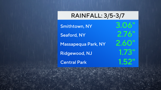
On average, 1.5-3 inches rain fell with that system, and that just adds to the surplus we are already running for 2024.
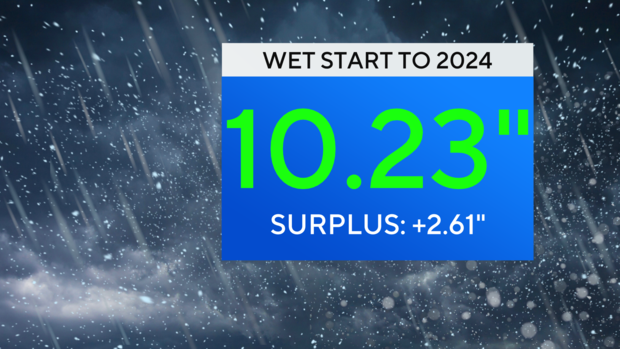
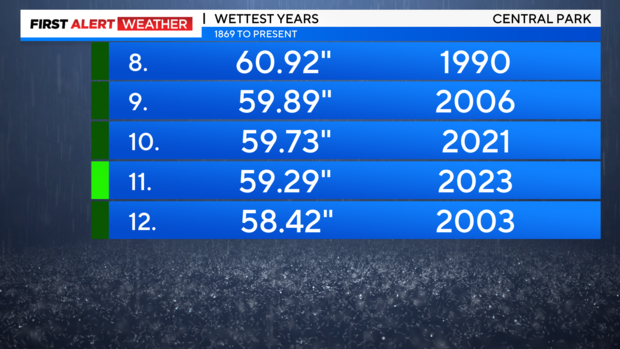
This is on the heels of 2023, which was a very wet year that finished as the 11th wettest year ever recorded.
While the official start of spring, known as astronomical spring, has yet to begin, meteorological winter, defined as the months of December, January, and February, was quite a wet one. Meteorologists measure the seasons in three month intervals, simply because it's easier to track the data within them.
The past winter was filled with numerous storms that delivered copious amounts of rain, but not much snow throughout the area. The succession and intensity of these storms led to severe flooding, especially across the river basins of northern New Jersey.

It wasn't our wettest winter ever, but it was well above average with an impressive total of 14.04 inches.
Why has it been so wet?
Given such a wet pattern, many people might be wondering what the culprit is. The answer is simple: El Nino.
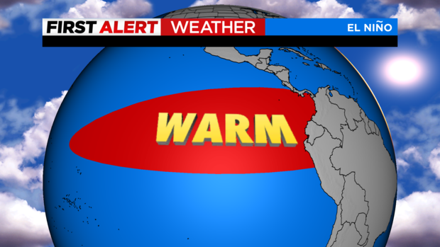
This phenomenon, characterized by the warming of the equatorial Pacific Ocean, occurs every 2-5 years, and can have far reaching global effects.
In our region, El Nino typically plays out in the form of warmer temperatures and above average precipitation, and that is exactly what transpired this winter season.
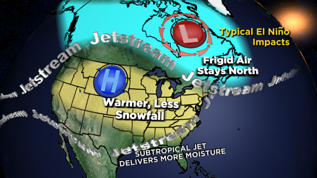
During an El Nino event, the northern branch of the Jetstream, also known as the polar jet, is pushed to the north and is not as strong, thus preventing arctic air from entering the region. On the flip side, the southern branch of the Jetstream, also known as the subtropical jet, becomes invigorated, and is able to travel further north than usual, thus funneling more moisture from the tropics in with it. The outcome of this El Nino winter was nearly a textbook example, however, this isn't always the case. The winter of 2009/2010 also featured El Nino, but unlike this one, saw more phasing of the polar and subtropical jet streams. The end result was a blockbuster snow season in which over 50 inches fell. El Nino's effects are greatest and peak during winter but can also influence weather in the seasons preceding and succeeding it.
El Nino Does Have Benefits
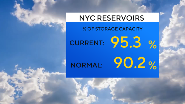
To the dismay of snow lovers, this winter was another disappointment. It's not all bad news though. Despite the ill effects caused by the flooding, the barrage of rainstorms in recent months has kept our reservoir levels at higher-than-normal levels. This will especially be helpful in the months ahead, as the wet patterns associated with El Nino is often followed by periods of drought.
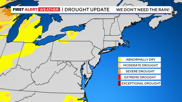
Speaking of drought, hardly anywhere in the Northeast and Mid-Atlantic regions are currently in drought, and El Nino is to thank for that. Also, last March saw the development of numerous wildfires across portions of New York and New Jersey due to dry conditions.
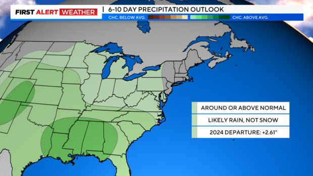
The likelihood of that unfolding again this March is much lower as a result of the saturated ground. The longer-term outlook also suggests that the wet pattern will continue for at least another month or so.
You can always check the latest conditions from the First Alert Weather Team.


