First Alert Weather: Wind and river flooding to remain a problem into Monday night
NEW YORK -- The rain from the latest storm to pummel the Tri-State Area is long gone, but the wind will be a factor well into Monday night.
A Yellow Alert has been issued for Monday due to the threat of high winds.
A Wind Advisory is in place for the entire region from 2 a.m. until 11 p.m. on Monday.
River Flood Warnings are in place along portions of the Passaic, Saddle, Millstone, Still, and Housatonic rivers through Wednesday morning.
It has been a rollercoaster of a week in terms of weather, and there is one more curve to get through before the ride ends. The latest storm to barrel through the region delivered another shot of heavy rain, which has led to river flooding across some of our local rivers. Rivers such as the Passaic have reached moderate flood stage. Flood warnings along these rivers are in place through early Wednesday.
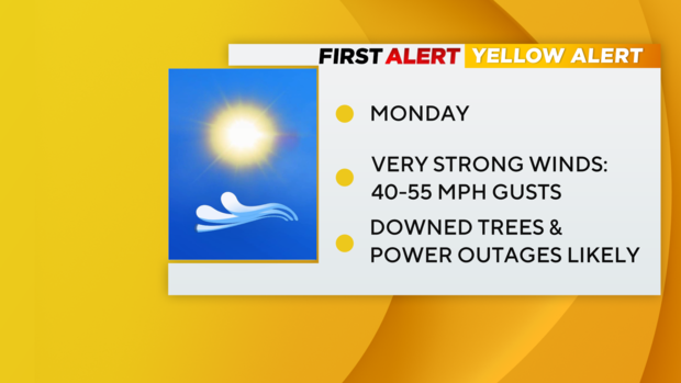
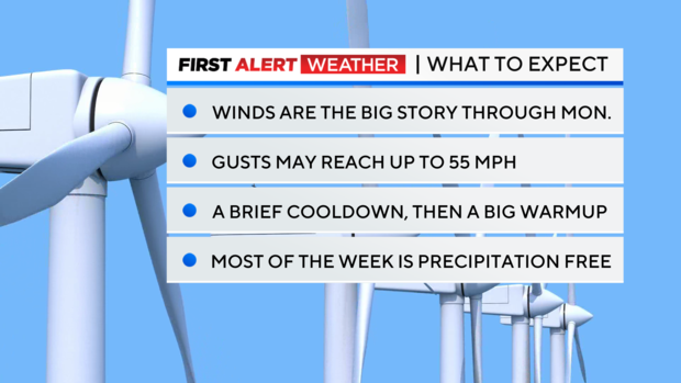
That storm is now long gone, having reached the Canadian Maritimes, yet its effects will still be felt through Monday. Since its departure from our region, the storm has deepened rapidly. Meanwhile, a strong area of high pressure has moved in behind it. There is a steep difference in pressure between these two systems, and thus strong winds will be the result. Those winds elevated on Sunday, but are expected to get even stronger by Monday afternoon. Gusts as high as 55 mph are possible.
That level of wind is capable of taking down trees, and even power lines, which could lead to power outages. The saturated ground makes trees more susceptible to being toppled. Wind chills will dip into the teens and 20s by Monday morning as a result of those howling winds. These winds will last through Monday night, eventually slackening by Tuesday morning, once the storm moves further into Atlantic Canada.
After the winds calm down, we are in for a nice treat. Beginning on Tuesday, a major warmup is in store for the rest of the week. Highs will surge into the 60s, and maybe even the 70s in some areas. It will feel just delightful. We'll also get a chance to dry out, as the next chance of rain doesn't arrive until later on Friday.


