Thunderstorms possible around NYC as region gets major warmup
Sunday forecast
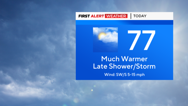
Despite some morning cloud cover and a few lingering showers, Sunday will shape up nicely with a brighter afternoon. It'll be much warmer once the warm front moves north and highs climb back into the mid 70!
Interior sections of New Jersey are likely to reach the low 80s.
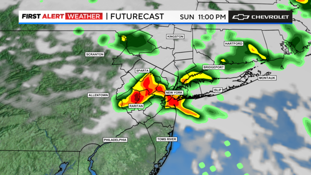
As temperatures rise, so too will humidity levels, which will contribute to the chance of some widely scattered thunderstorms in the evening hours.
Most of the daylight hours remain dry, before a quick round of showers and embedded thunderstorms swings through mainly after sunset. We're not expecting anything major, but a brief downpour is possible.
First Alert Weather maps
- Live Tri-State Area radar
- Live Long Island radar
- Live NYC northern suburbs radar
- Live Jersey Shore radar
- Tri-State temperatures
Monday forecast
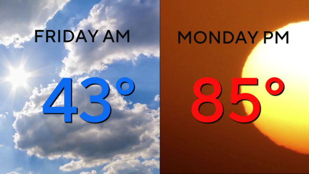
Once those storms clear out by Sunday night, temperatures will rise even further by Monday and we'll get a taste of summer! Many locations will see highs in the mid to upper 80s.
A 90-degree reading or two could even be observed in inland areas of the Garden State. Along the coasts, areas north and east of New York City will be a bit cooler with high temps in the 70s. A very nice day!
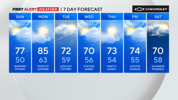
More clouds roll in Tuesday before another shower/storm risk by late afternoon to close out April.


