First Alert Weather: Yellow Alert for rain showers and thunderstorms
Alert: Yellow Alert for this morning through the first half of the afternoon for a couple lines of showers with a few embedded t'storms. Downpours and gusty winds are possible.

Advisories: High rip current risk along south facing NY beaches today. High rip current risk and high surf advisory tomorrow into Saturday.

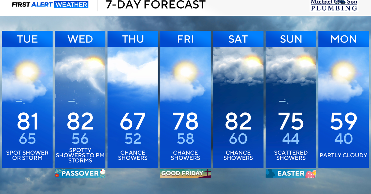
Forecast: A line of showers/t'storms pushes through this morning, then another round sweeps through midday through the mid-afternoon hours. After that, we'll see partial clearing with temps only in the upper 60s this afternoon. Tonight will be much cooler and blustery with temps falling to around 50 in the city with 40s across our suburbs, perhaps an upper 30s reading well N&W around daybreak.

As for the day tomorrow, it will certainly feel like fall out there: blustery and even cooler with highs only in the low to mid 60s... normal for mid October.

Looking Ahead: Saturday will remain cool with mostly sunny skies and highs in the upper 60s to near 70. As for Sunday, temperatures start to bounce back with a slight chance of showers late in the day. Expect highs closer to normal in the mid 70s.