First Alert Weather: Yellow Alert due to hot, humid and stormy conditions for July 4th
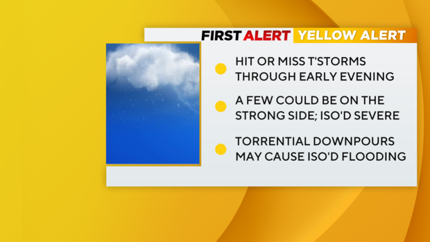
Alert(s): Yellow Alert through early evening for pop-up downpours and thunderstorms that can cause interruptions to holiday plans.
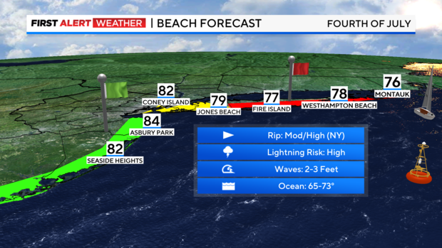
Note(s): High rip current risk today for Suffolk County beaches, moderate for the rest of Long Island, low for New Jersey.
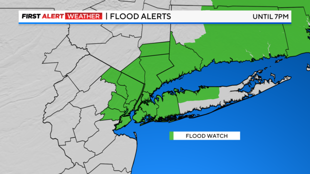
A flood watch has been issued for parts of our area until 7 p.m.
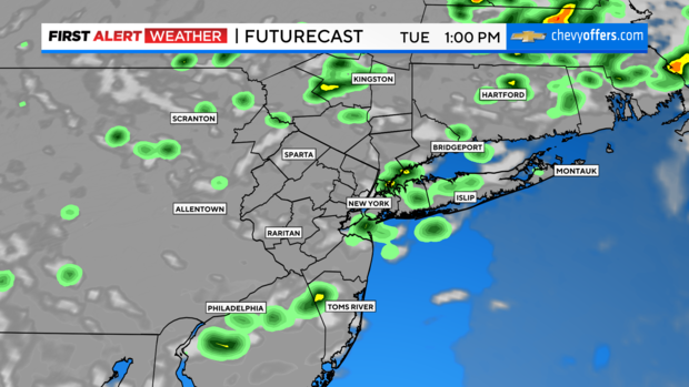
Forecast: Tuesday will feature hit or miss showers/storms, mainly focused from midday through early evening (approx 11 a.m. - 6 p.m.). Much like yesterday, not everyone will see them.
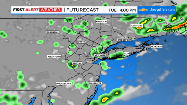
Overall, the heavy rain/isolated flooding risk looks like the main threat, with just an isolated severe/damaging wind threat in any stronger cells. Otherwise, clouds with some sun and very humid.
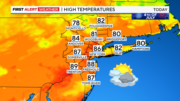
Highs will be in the mid 80s, feeling closer to 90.
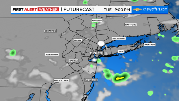
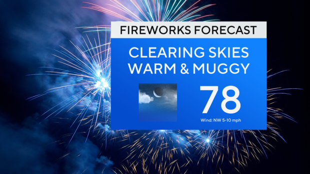
The good news is it continues to look like activity will dissipate earlier than Monday and exit before sunset, with dry conditions for fireworks. It turns partly cloudy overnight with lows in the low 70s.
Looking Ahead: Tomorrow will be brighter, drier, hot, and humid.
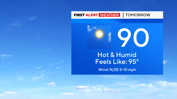
Temps will get into the low 90s inland (around 90 in the city) with heat indices in the mid 90s. Can't completely rule out a very spotty shower/storm in the afternoon from the daytime heating, but most if not all of the area will be hot & dry.
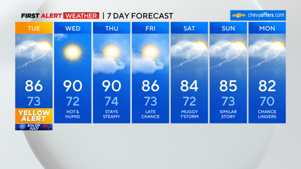
Similar conditions for Thursday as well.


