Red Alert: Timeline of thunderstorms set to bring heavy rain, strong wind and flood risks
Alerts
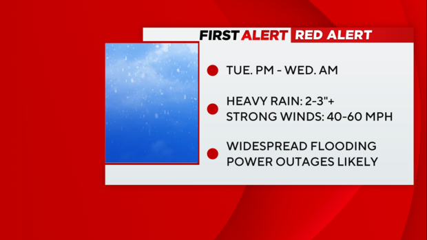
- Red Alert Tue PM into Wed AM for heavy rain, gusty winds, coastal flooding and the likelihood of widespread inland flooding.
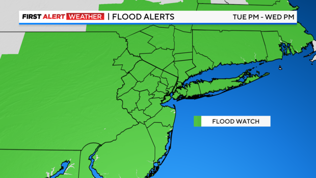
- Flood Watch for the entire area from Tuesday PM through Wednesday for 2-3+"
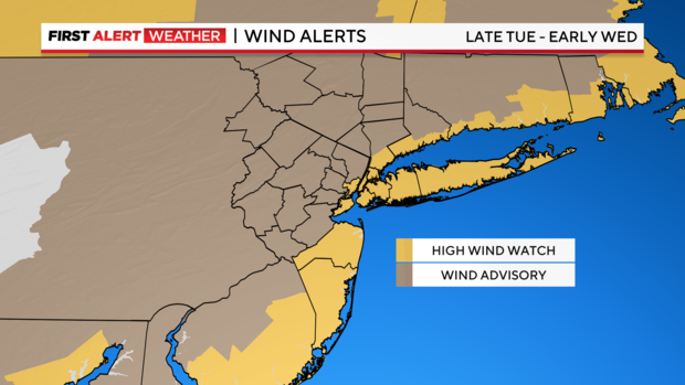
- High Wind Watch and Wind Advisories for the entire area Tue PM through early Wednesday for 50-60 mph wind gusts.
Coastal Flood Watch/Warning from Tuesday PM through midday Wednesday for moderate to major flooding.
Forecast
Wednesday: Minor to major coastal flooding through midday. Leftover showers and gusty winds with temperatures falling into the 40s.
Storm timeline
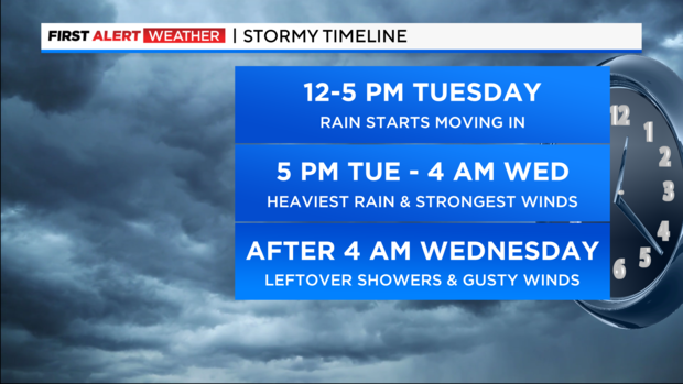
5 PM Tuesday- 4 AM Wednesday: This is when the storm is at its peak. Throughout this time frame, torrential rain and strong winds will unfold. A few embedded thunderstorms are even possible. Freshwater flooding is very likely, especially in New Jersey, but so too is coastal flooding and beach erosion, as onshore winds pile waves along the coast. This would be particularly bad during the morning high tide cycle. Those winds may gust between 40-50 mph at times. Higher gusts are possible at the immediate coast, particularly coastal areas of Long Island and New Jersey, where gusts may reach up to 60 mph. Temperatures rise into the mid 50s throughout the overnight hours.
Rest Of Wednesday: Though the heaviest rain will already be over for most areas, some lingering showers are still possible. The gusty winds will continue through the day, gusting between 25-40 mph. Final rain totals will average between 2-3+ inches, with higher totals in some locations. Residual coastal and flooding from the rain is very likely at this time. Rivers will also start to rise, with flooding becoming more prevalent later in the day and into Thursday. Highs will be reached early in the morning, with falling temps throughout the day.
Potential impacts
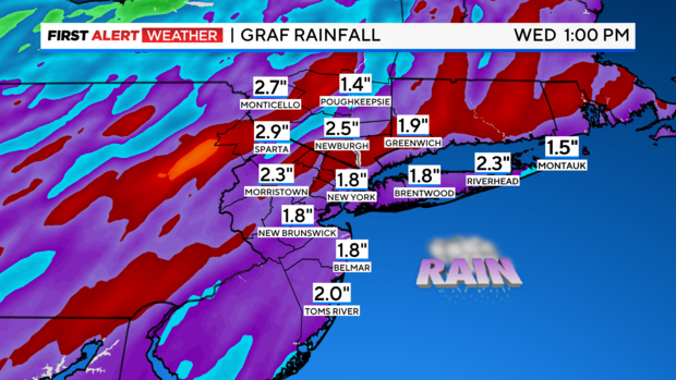
Heavy Rain: The storm will be able to tap into deep, tropical moisture all the way from the Caribbean Sea. Because of this, flooding rain is our greatest concern. Forecasted rainfall totals are between 2-3+ inches. These numbers would be troubling at any time, however, with an already saturated ground from numerous recent storms, the flash flood risk is much greater. For areas that received snow this weekend, that heavy rain on top of the snowpack that will melt rapidly and could lead to moderate and major riverine flooding. Of particular concern are cities and towns in and around the Passaic and Raritan River basins.
Damaging Winds: Given the strength of the storm, it will be capable of producing damaging winds between 40-60 mph. The saturated ground will make trees more susceptible to getting toppled over and powerlines may also get taken down with them, so therefore, power outages are highly likely.
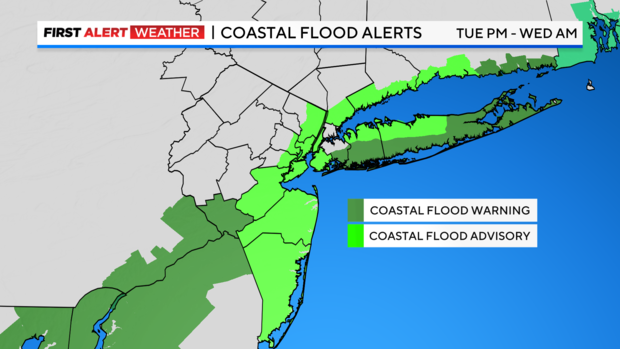
Coastal Flooding: Also, as a result of the strength of this storm, those strong winds could send powerful waves onshore, and thus lead to moderate and severe coastal flooding, as well as beach erosion. We're talking 3-4 feet of inundation potentially. To make matters worse, the proximity to the New Moon on 1/11 will have tides running higher than normal.
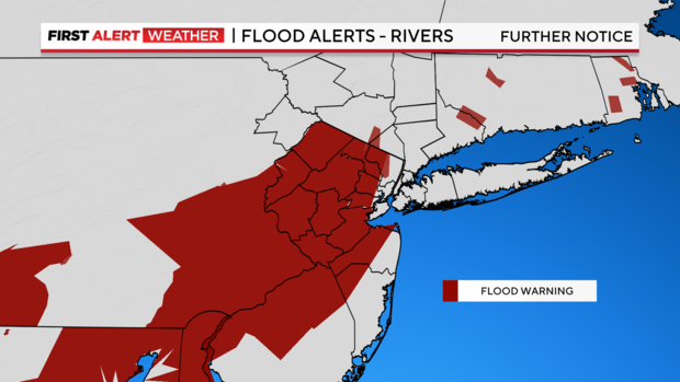
Seventy-five percent of New Jersey was under a Flood Warning on Tuesday night due to excessive rainfall.
Follow our First Alert Weather team for the latest track and timing as the storm develops.


