First Alert Forecast: Temps top out in low 80s under mix of sun and clouds
Things are looking good to close out this final weekend of August.
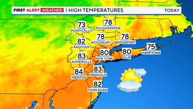
Expect a mix of sun and clouds today with highs topping out in the upper 70s and low 80s. Humidity will be noticeably lower as well, so it'll feel better out there.
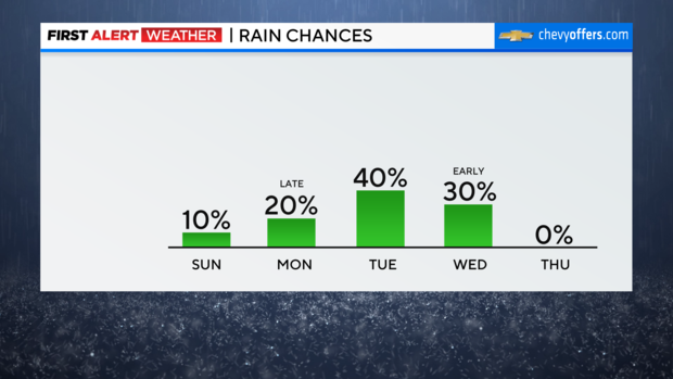
There is the slightest chance of an isolated shower, mainly to the east where instability will be a bit higher. Much of the region will remain dry, but it's worth the mention.
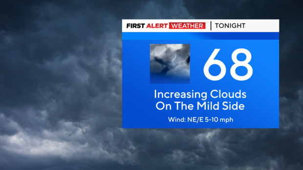
Other than clouds building overnight, it remains relatively quiet. Lows will be in the 60s, with some 50s in the higher elevations north and west.
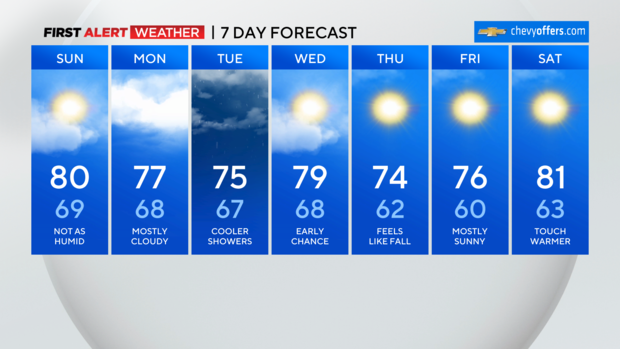
Monday will feature more cloud cover as we get into an onshore flow. This will hold temps in the 70s and bring along a spotty shower risk. The best chance of any wet weather will be late in the day as it looks right now, and then especially into Tuesday morning.
While the tropics remain active, we won't see any direct impacts from Hurricane Franklin. However, it will bring some high surf and dangerous rip currents by midweek as it curves and passes offshore.
Elsewhere, another soon-to-be hurricane likely impacts the Florida gulf coast late in the week and will need to be watched closely for any changes.
As always, we'll have the latest right here. Enjoy the rest of your weekend!


