California braces for "life-threatening" flood risk ahead of 2nd winter storm
Another winter storm spanning multiple days will be moving into California Saturday night and is expected to last until Tuesday or Wednesday.
The National Weather Service is calling the system "the largest storm of the season" and is expecting the storm to have "dangerous, even life-threatening impacts."
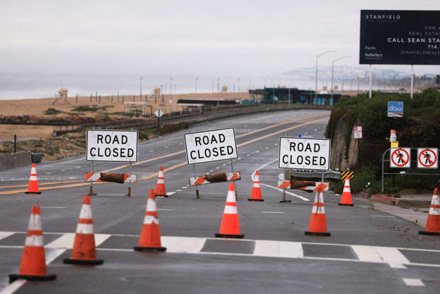
Californians were rushing to prepare Saturday, filling up sandbags and lining streets with protective concrete barriers. In Long Beach, crews were building massive beach berms to brace for a dangerous atmospheric river that could drop rain non-stop for days.
In Ventura County, north of Los Angeles, some communities were under mandatory evacuation orders ahead of the storm.
The California Office of Emergency Management reported that it had at the ready 21 swift water rescue teams, seven million prepositioned sandbags and more than 1,200 pieces of snow removal equipment.
"If you don't need to be on the roadways during the storm event, we're asking you to please, please postpone any non-essential travel," Tony Tavares, director of Caltrans, said in a news conference Friday.
Gov. Gavin Newsom Friday declared a state of emergency ahead of the storm for Humboldt, Imperial, Monterey, San Mateo, and Santa Cruz counties.
The strong storm is expected to drop 3 to 6 inches of rain in Southern California's valleys and coastal communities, and 6 to 12 inches in the mountains. Much of the downpour is expected to occur during a 24 to 36-hour period from Sunday into Monday.
A flood watch will go into effect from Sunday afternoon through Tuesday for the entire coast of Southern California including, Santa Barbara, Ventura, Los Angeles, and Orange Counties. Other parts of California that will be hit by the deluge include the Bay Area and Sacramento.
High winds expected in Southern California
A winter storm watch will be in effect in the eastern San Gabriel Mountains from Saturday night through Tuesday afternoon, with forecasters predicting as much as 2 to 4 feet of snow above 7,000 feet, as much as 20 inches as low as 6,000 feet, and 8 inches at 5,000 feet. Winds will also gust in that area at 80 mph.
Extra shelters are expected to be open on Saturday and Sunday to accommodate the homeless population in Los Angeles. Residents can also call 2-1-1 for transportation to a shelter.
Los Angeles Mayor Karen Bass announced several measures the city is taking to weather the storm and is encouraging residents to stay home on Sunday.
LA County Public Works has issued a phase 3 mudflow forecast for the Fish Fire area in the city of Duarte. Mel Canyon Road in the city of Duarte will remain closed from Brookridge Road to Fish Canyon Road starting Sunday, February 4, at 6 PM until Tuesday, February 6, at 10 AM.
There are evacuation orders and warnings in place for areas in Ventura County starting at 5 p.m. on Saturday until 5 p.m. on Sunday.
A flood watch will be in effect in the Bay Area
For most of the Bay Area, a Flood Watch took effect beginning at 4 p.m. Saturday and running until 10 a.m. Monday. Wind advisories will begin on Saturday night, with widespread 40 mph or greater wind gusts expected.
Wind is likely to be a bigger threat than Wednesday's storm. The strongest winds will occur Sunday morning and will be capable of significant tree damage with rain-saturated soils around the region. There will be high wind warnings in Santa Cruz and Castroville as well beginning Saturday night.
Excessive rainfall will hit Sacramento area
Sacramento will be mostly dry until Saturday night, with the bulk of the rain arriving early Sunday and continuing through the afternoon. Snow will begin to pick up across the Sierra as this storm moves in from the south, forecasters say.
Wind gusts up to 60 to 70 mph will hit the Sacramento Valley, San Joaquin Valley and foothills. Sierra mountain passes and peaks could see gusts of 70-plus mph.
The NWS has issued a High Wind Warning starting at 2 a.m. Sunday through 4 a.m. Downed trees and widespread power outages will be possible. Excessive rainfall possibly resulting in flooding will hit the area, and a Flood Watch will be in effect from Sunday to Monday.
Excessive rainfall will result in flooding of rivers, creeks, streams and flood-prone areas, the NWS says. Creeks and streams may rise out of their banks. Flooding may occur in poor drainage areas and urban areas on local roads where drains become clogged
— CBS Bay Area, Bay City News Service, Ashley Nanfria and Elise Preston contributed to this report.


