South Florida to see sunshine return, lower rain chances after soggy week

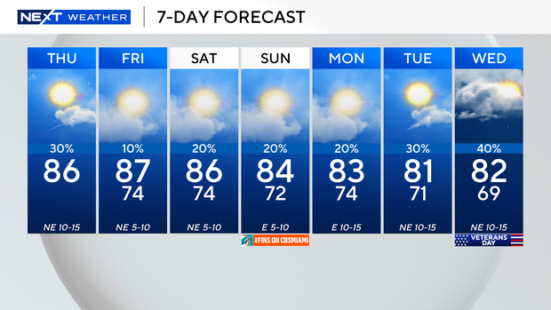
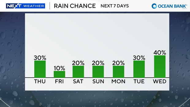
After days of drenching downpours across South Florida, we'll enjoy more sunshine and lower rain chances on Thursday and through the weekend.
Only a few showers are possible on Thursday, but some roads are still flooded and there is still some ponding due to all the recent wet weather.
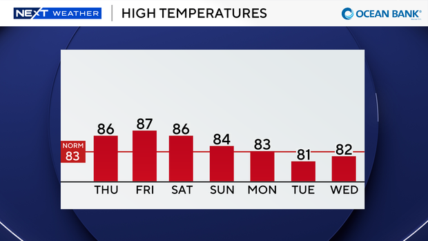
It was also a mild start to the day with temperatures in the upper 70s. High temperatures are expected to climb into the low to mid-80s on Thursday afternoon with brighter skies.
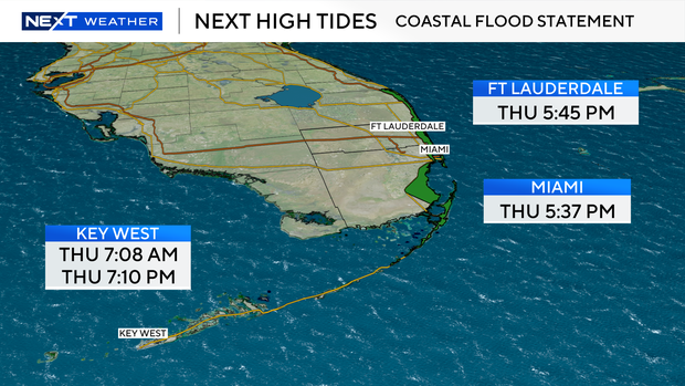
A coastal flood statement is in effect as minor saltwater flooding will be possible around the time of high tide.
On Thursday, the water levels will be highest between 4 p.m. and 6 p.m.
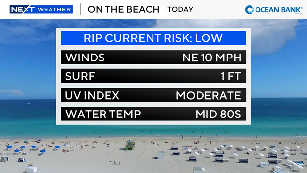
Conditions have improved for beachgoers and boaters too due to a lighter breeze.
There is a low risk of rip currents and no alerts or advisories for boaters along the Atlantic waters or the Keys.
As high pressure builds in, drier air moves in and decreases the rain chance even more tomorrow. Highs will climb to the upper 80s under mostly sunny skies.
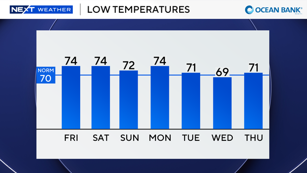
This weekend the humidity will be lower and we'll enjoy comfortable morning lows in the low 70s. Highs will climb to the mid 80s.
Spotty showers will be possible Saturday and Sunday.
The 2026 Atlantic hurricane season isn't over until the end of November.
The CBS News Miami NEXT Weather team is tracking a broad, non-tropical area of low pressure located a few hundred miles south of Bermuda producing some disorganized convection mainly to the east of its center.
This system has a medium potential of acquiring subtropical characteristics as it moves eastward over the western and central Atlantic.
This disturbance does not pose a threat to South Florida or the U.S.