South Florida to see increasing rain, flood threat starting Tuesday

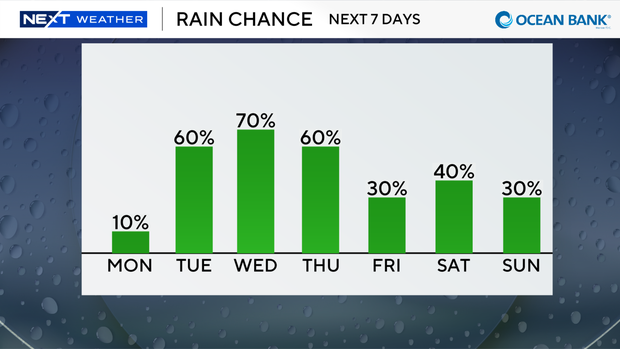
After a cool, dry weekend, we are getting ready for a warmer and windy weather pattern with rain chances rising this week.
A comfortable start this morning but not as cool as the last few days.
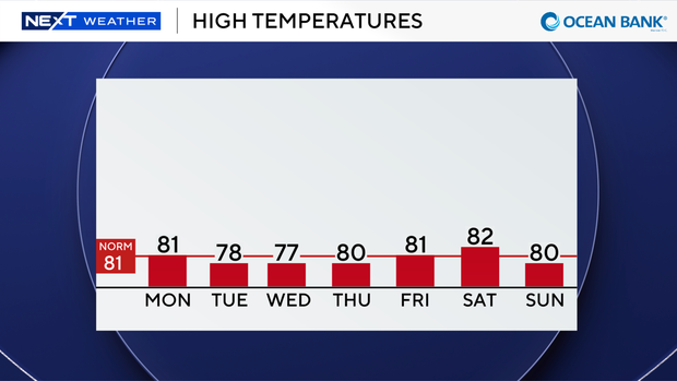
Highs will climb to around 80 degrees with low rain chances through the afternoon.
This evening and tonight spotty showers will move in.
There is a low risk of rip currents along our Atlantic beaches today.
A small craft advisory is in effect for boaters along the Atlantic waters, and a small craft caution has been issued for the Keys waters.
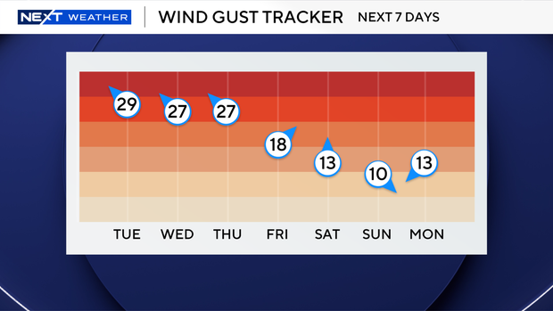
As winds increase over the next few days, beachgoers and boaters will need to be aware of hazardous conditions.
Wind gusts could reach 30 to 35 miles per hour. An area of low pressure will move in and bring plenty of moisture with it.
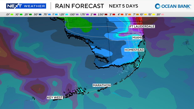
Scattered showers and storms will develop Tuesday with the potential for heavy rain and flooding.
The Weather Prediction Center has placed much of Broward and Miami-Dade under a slight risk of flash flooding.
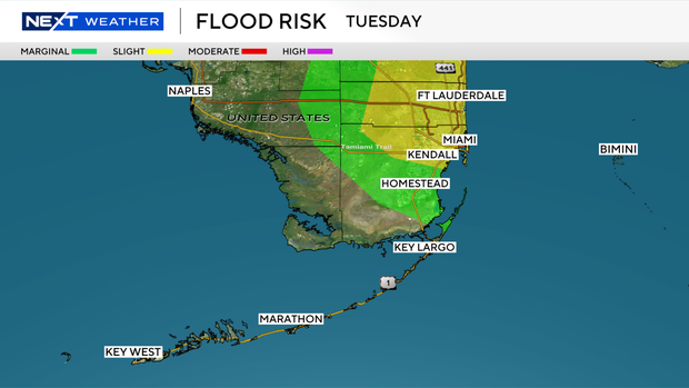
The chance of rain is even higher on Wednesday with more widespread rain expected.
And most of Broward and Miami-Dade will be under a slight risk of flash flooding again on Wednesday.
We stay unsettled with high rain chances Thursday.
The rain chance will decrease Friday and into the weekend with highs in the low 80s.