Near-record high temperatures expected across South Florida Friday with dangerous heat likely through Mother's Day weekend

Mother Nature is serving up hot, humid weather for Mother's Day weekend across South Florida.
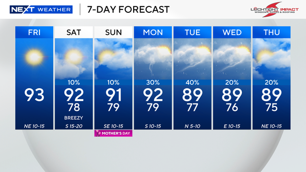
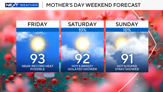
Near-record high temperatures will be possible on Friday as highs soar into the low 90s. The average high temperature in Miami is 86 degrees, but we will be well above that.
The CBS News Miami NEXT Weather team is forecasting a high temperature of 93 degrees in Miami today.
The old record in Miami is 94 degrees, which was set back in 2022. The forecast high temperature in Fort Lauderdale today is 91 degrees, and the old record o f93 degrees was set in 1998. Key West is expected to get to 88 degrees, and the old record of 91 degrees was set back in 1873.
When you factor in the humidity, it will feel like the mid- to upper 90s. We will enjoy plenty of sunshine and dry conditions.
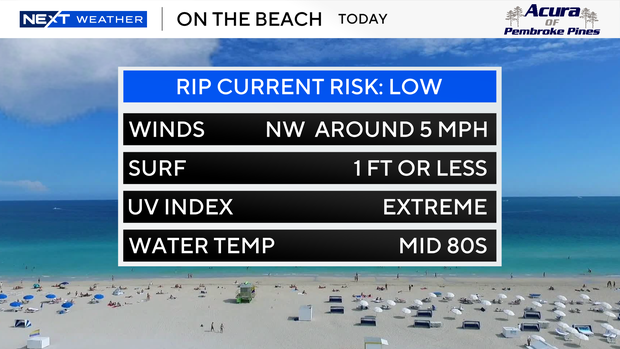
If you're planning on heading to the beach, there is a low risk of rip currents on Friday, but a moderate risk of rip currents on Saturday and Sunday.
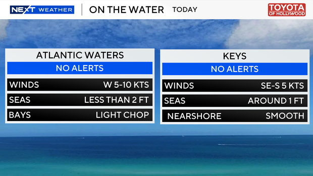
There are no alerts or advisories for boaters along the Atlantic waters or Keys waters.
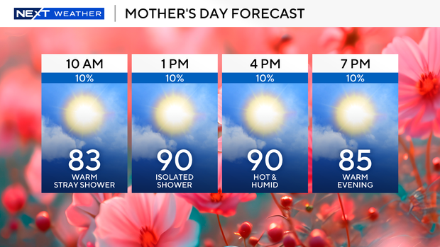
The heat wave continues on Saturday and Sunday as high temperatures remain in the low 90s and feels-like temperatures will be close to the triple-digits.
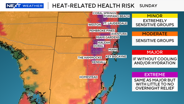
There is a major risk of heat-related illnesses for most of South Florida on Saturday and Sunday, which means heat exhaustion or heatstroke will be possible without proper cooling and/or hydration.
In addition, on Sunday some inland areas will have an extreme risk of heat-related illnesses. That means there will be little to no relief overnight.
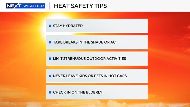
The National Weather Service is urging residents in South Florida to take the necessary precautions to stay safe in this unseasonable heat. In addition to staying hydrated, residents should try to stay in the shade or air conditioning during the hottest part of the day.
It is important to limit strenuous outdoor activities. Never leave children or pets in cars and check on the elderly.
We will enjoy mainly dry weather this weekend courtesy of high pressure, but isolated showers can't be ruled out. The chance of rain increases early next week due to moisture moving in.
Monday we will stay hot with high temperatures in the low 90s with spotty showers possible.
Scattered showers and thunderstorms are likely next Tuesday and Wednesday. The wet weather will bring some relief with high temperatures dropping slightly into the upper 80s.