Showers, storms possible in South Florida on Monday before warm and dry conditions move in later this week

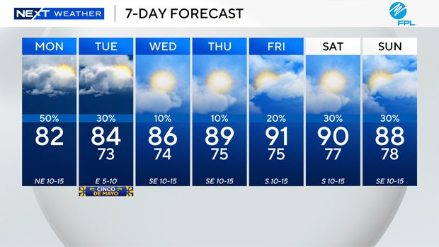
Keep your umbrella close as scattered showers and thunderstorms will be around South Florida on Monday due to a stalled frontal boundary and plenty of moisture.
A few showers popped up on Monday morning, and another round of rain is expected Monday afternoon and evening.
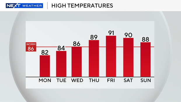
High temperatures will remain below average in the low 80s due to the clouds and wet weather around.
There is a moderate risk of rip currents along our Atlantic beaches. Small craft should exercise caution over the Atlantic waters, but there are no alerts or advisories for boaters over the Atlantic waters or Keys waters on Monday.
Lingering moisture will lead to passing showers on Tuesday, but the rain won't be as widespread. High temperatures are expected to climb close to the mid-80s.
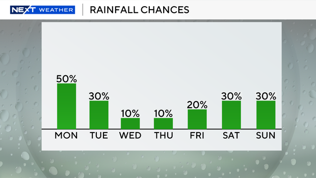
It will be drier and warmer mid- to late week as high pressure builds in.
The chance of rain will be low on Wednesday and Thursday as high temperatures rise to the upper 80s.
Even hotter temperatures are expected at the end of the week as highs climb into the low 90s on Friday and Saturday.
Spotty storms will be possible this weekend.
Sunday will be warm with high temperatures in the upper 80s with the potential of seeing a few showers.