South Florida sees flash flood risk due to threat of heavy rain, thunderstorms starting Thursday

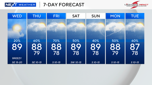
It will be warm and breezy in South Florida on Wednesday with spotty showers possible.
High temperatures are expected to climb into the upper 80s, and it will feel like the mid- to upper 90s when you factor in the humidity.
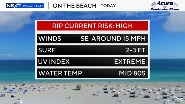
The strong onshore wind is leading to a dangerous high risk of rip currents along the Atlantic beaches.
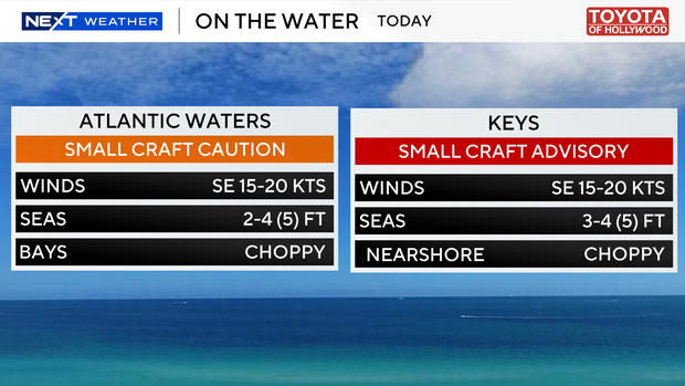
Small craft should exercise caution over the Atlantic waters, and a small craft advisory is in effect for boaters over the Keys.
On Thursday the chances of rain will rise as scattered showers and thunderstorms will develop due to a surge of moisture.
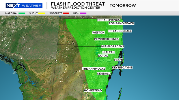
NOAA's Weather Prediction Center has placed South Florida under a Level 1 risk of excessive heavy rainfall due to the potential for heavy downpours and isolated flooding.
More widespread showers and thunderstorms will be possible on Friday due to an upper level low that will enhance the moisture across our area.
The CBS News Miami NEXT Weather team will monitor the forecast models to determine if a NEXT Weather Alert day will be needed.
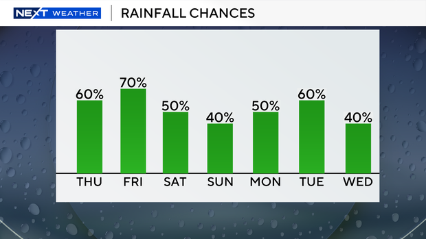
Heavy rain and localized flooding will be possible.
Keep the umbrellas close through the weekend, however, as scattered showers and thunderstorms will be around on Saturday and Sunday.
High temperatures will remain in the upper 80s the rest of the week, and it will feel like it's close to the triple-digits due to the high humidity.