Parts of South Florida could see severe thunderstorms, flash flooding on Tuesday

Another round of scattered thunderstorms is expected across parts of South Floirda on Tuesday.
We enjoyed mostly dry conditions on Tuesday morning with temperatures in the upper 70s and low 80s. High temperatures will again soar into the low 90s on Tuesday with some record heat possible.
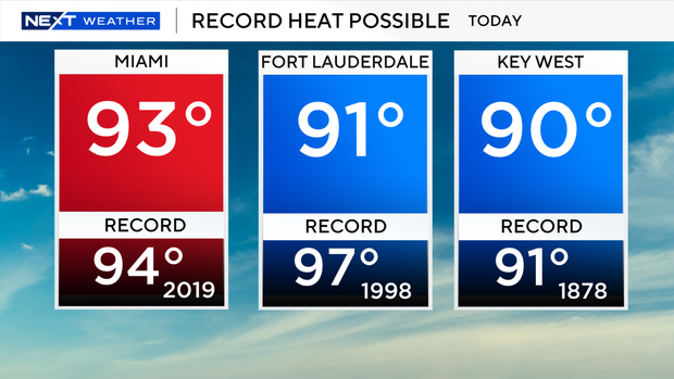
When you factor in the humidity, it will feel like the triple-digits once again.
The heating of the day combined with plenty of moisture in the atmosphere will help to fuel the thunderstorm threat on Tuesday afternoon and evening.
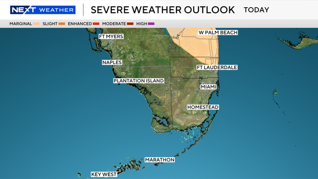
You'll want to stay weather aware on Tuesday as the Storm Prediction Center placed portions of northern Broward County under a Level 1 risk of severe weather as isolated strong to severe thunderstorms will be possible and could perhaps bring strong winds, small hail and isolated flooding.
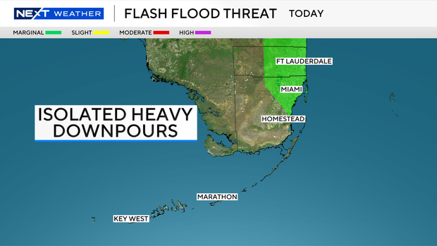
The Weather Prediction Center placed parts of Miami-Dade and Broward counties in a Level 1 risk of excessive, heavy rainfall due to the potential for heavy downpours.
There is a low risk of rip currents along our Atlantic beaches. There are no alerts or advisories for boaters over the Atlantic waters or Keys waters.
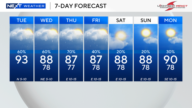
The chance of rain will stay high on Wednesday and Thursday. Scattered showers and thunderstorms will develop with some heavy rain at times.
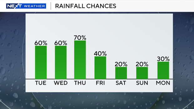
Friday will be a transitional day with some passing storms.
Drier air will move in by the weekend to lower our rain chances and lower out temperatures as high temperatures will be in the upper 80s instead of the low 90s.
Spotty showers will be possible on Saturday and Sunday.