Showers, thunderstorms possible across South Florida this weekend, but it won't be as hot

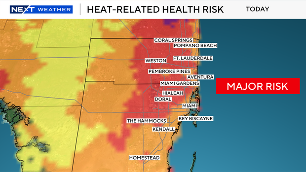
After a sizzling week across South Florida with record-breaking heat, this weekend isn't forecast to be as hot due to more rain expected.
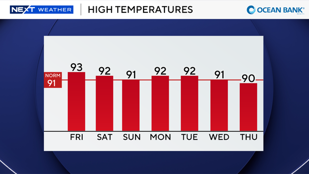
Instead of the upper 90s, high temperatures will be closer to average and in the low 90s on Friday.
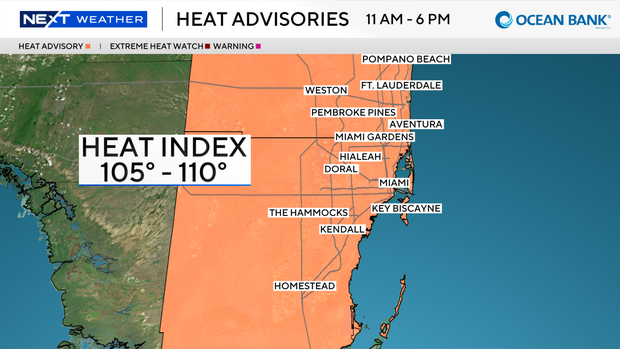
Another heat advisory is in effect from 11 a.m. to 6 p.m. due to the heat index values expected to reach around 105 to 110 degrees.
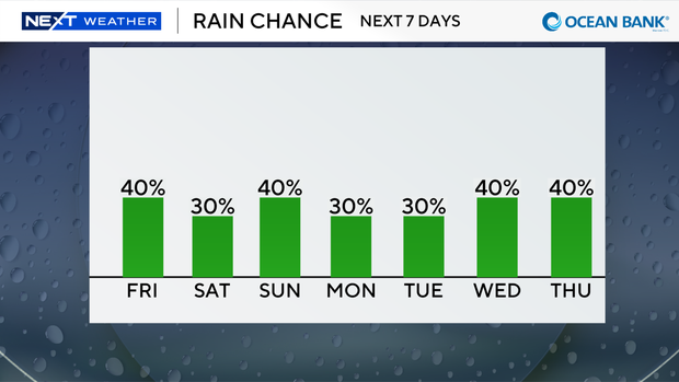
Scattered showers and thunderstorms will develop later Friday, and storms that develop could produce heavy downpours, lightning and gusty winds.
There is a low risk of rip currents along the Atlantic beaches, and the UV index will be very high.
There are no alerts or advisories for boaters over the Atlantic waters or Keys waters.
This weekend, high temperatures will remain seasonably hot in the low 90s with feels-like temperatures in the triple digits when you factor in the humidity.
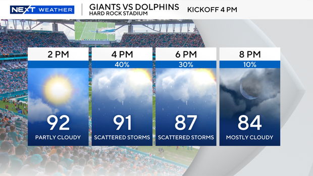
Spotty showers and thunderstorms will develop on Saturday and Sunday.
The CBS News Miami NEXT Weather team is tracking two areas in the Atlantic for possible tropical development.
There are no immediate threats to South Florida.
The National Hurricane Center said that the non-tropical area of low pressure located several hundred miles north-northeast of the Azores has a low potential of cyclone development.
This system could acquire some subtropical or tropical characteristics on Saturday or early Sunday while it moves east-southeast at 10 to 15 mph toward Portugal and northwestern Spain.
There is also a weak area of low pressure located over the central subtropical Atlantic a few hundred miles east-southeast of Bermuda producing a disorganized area of showers and thunderstorms.
This system has a low potential of development as it drifts west-southwest through Sunday and then turns northward early next week.