South Florida to see another sunny, warm day but rain and storm chances increase this weekend

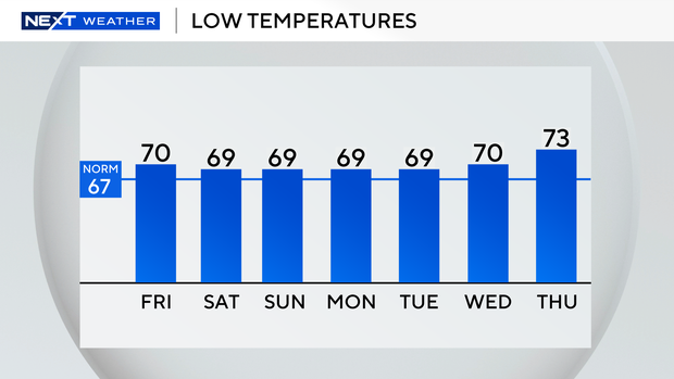
It was a milder start in South Florda on Thursday with temperatures in the upper 60s in Broward and Miami-Dade counties.
Temperatures were in the low 70s across the Florida Keys.
Some patchy dense fog developed over the inland areas and over on the southwest coast of Florida.
The air quality is moderate for much of Miami-Dade and parts of coastal Broward County near Fort Lauderdale.
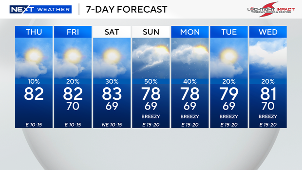
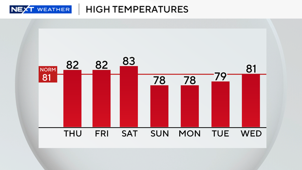
On Thursday afternoon, we'll enjoy plenty of sunshine and mainly dry conditions as high temperatures warm into the low 80s.
There is a moderate risk of rip currents along the Atlantic beaches, and the UV index will be very high again on Thursday.
There are no alerts or advisories for boaters over the Atlantic waters and the Keys waters.
We will stay warm through Friday with only a few showers possible. High temperatures will remain near normal in the low 80s.
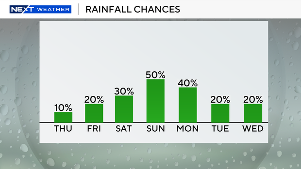
The chance of rain will increase this weekend as a cold front approaches and brings moisture with it.
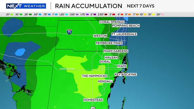
Saturday will be warm with high temperatures close to the mid-80s and the potential for spotty showers.
Scattered showers and thunderstorms will be possible on Sunday with slightly cooler high temperatures in the upper 70s.
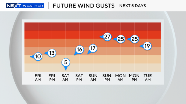
The breeze will build and it will be downright windy at times.
We will remain unsettled with passing showers on Monday with high temperatures in the upper 70s.