Windy conditions continue in South Florida before warmer weather returns this week

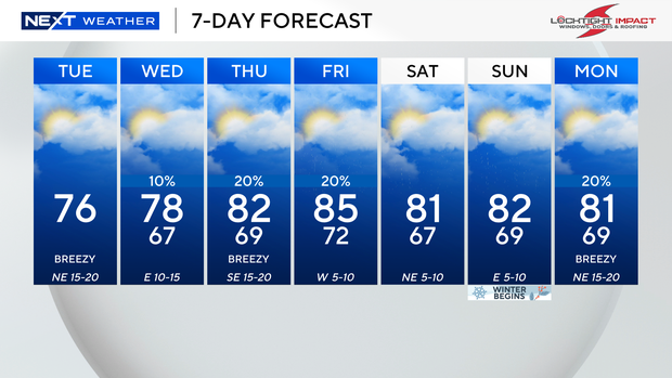
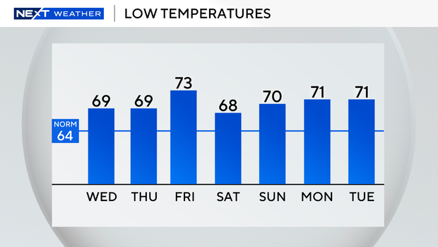
A cooler start this Tuesday morning with low to mid 60s inland and upper 60s closer to the coast.
A breezy, mainly dry day ahead with highs in the mid 70s under mostly sunny skies.
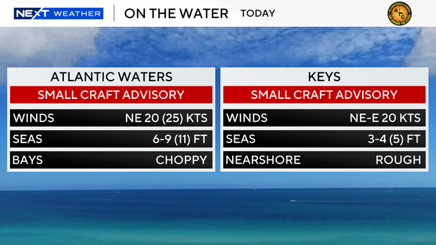
The strong onshore winds will lead to dangerous beach and marine conditions again today.
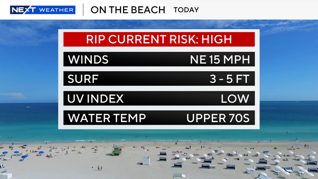
There is a dangerous high risk of rip currents along the Atlantic beaches. A small craft advisory continues for the Atlantic waters and the Keys waters.
Wednesday morning will be cool with lows in the 60s. As the wind shifts out of the east, highs will be milder in the upper 70s.
Warmer late week as highs rise back into the low 80s with the potential for spotty showers.
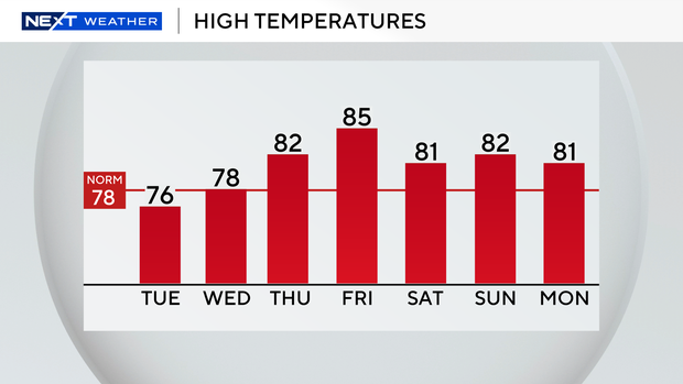
Even warmer on Friday with highs in the mid 80s. Moisture will move back in ahead of our next cold front and allow for spotty showers to develop on Friday.
This weekend will be slightly cooler with lows in the upper 60s Saturday and Sunday morning.
Highs will climb to the low 80s with low rain chances.