Tumbling temperatures in South Florida will have residents reaching for the sweaters

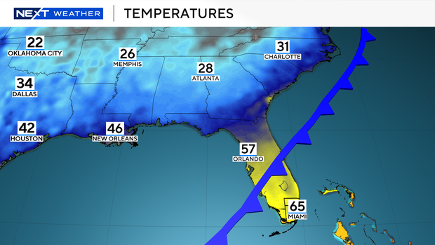
The NEXT Weather Team is tracking big changes for South Florida over the next 24 hours as a strong cold front moves into the area today.
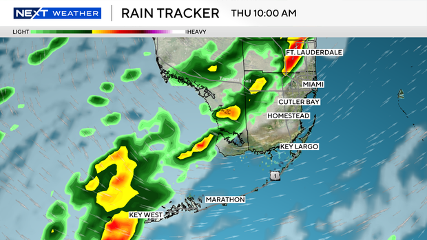
Scattered showers and isolated storms will be possible Thursday morning ahead of the front.
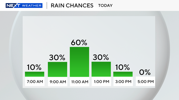
Highest rain chances will be between 10 a.m. and noon.
Breezier, cooler, and drier conditions arrive for the afternoon as highs peak in the lower to mid-70s and gusts up to 30 mph are possible.
These breezy conditions will create rough conditions at the coast and lead to small craft advisories for boaters in the Atlantic waters and Florida Keys.
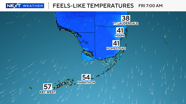
Temperatures tumble across South Florida overnight into the upper 30s and 40s.
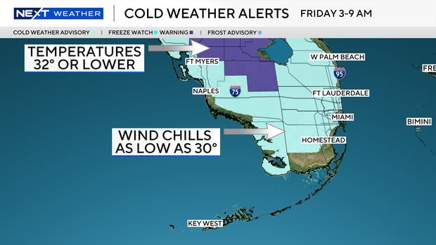
A Cold Weather Advisory will be in effect from 3 a.m. to 9 a.m. Friday for most of Miami-Dade and Broward counties as "feels like" temperatures could drop into the 30s for many.
Have your winter coat and sweater nearby for the first half of the day and keep a light jacket nearby for Friday afternoon as highs will struggle to make it to the upper 60s to end the workweek.
Chilly mornings and mild afternoons are expected over the weekend with highs in the mid-70s.
Another cold front is expected to arrive late Sunday and cool the area off again ahead of Dr. Martin Luther King Jr. Day.
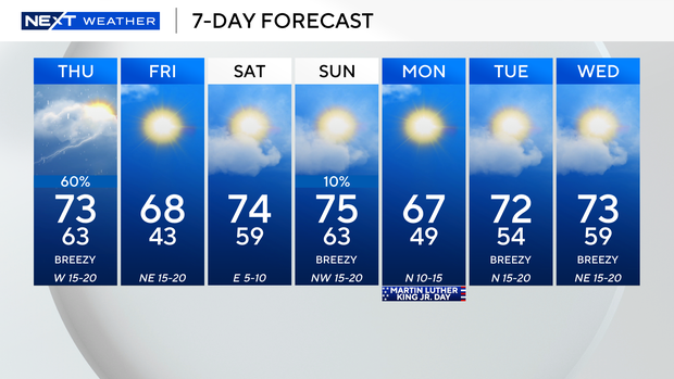
Temperatures will start in the upper 40s and peak in the upper 60s.
Looking ahead to the College National Football Championship game on Monday, we can expect chilly and dry conditions for the evening.