How is Hurricane Imelda impacting South Florida? See its effects and path.
For the latest on Hurricane Imelda, visit the National Hurricane Center's website.
Tropical Storm Imelda strengthened into a Category 1 hurricane early Tuesday, according to the National Hurricane Center.
It's the ninth named storm of the 2025 Atlantic hurricane season.
Indirect impacts to the U.S. include high rip current risk and higher surf.
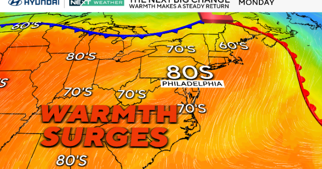
Gusty winds up to 25 mph or stronger will be possible as Hurricane Imelda remains close enough to Florida. Drier, stable air will settle in and lower rain chances since South Florida is on the western and outer edges of Imelda's counterclockwise circulation.
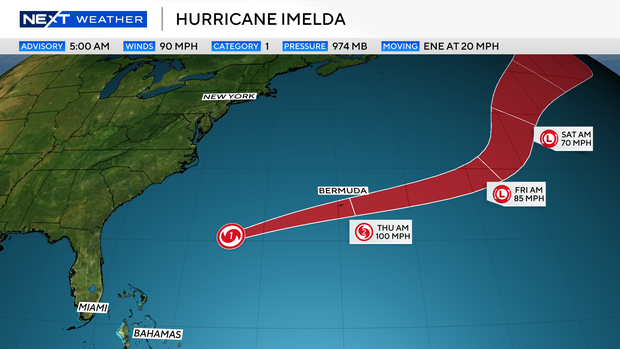
Imelda will continue to move northeast and head toward Bermuda Wednesday. It could strengthen to a Category 2 storm by Thursday morning.
As Imelda moves northeastward and away from the U.S. coastline, South Florida will still be dealing with indirect impacts along the coast. Hazardous beach and marine conditions will continue.
Where is Imelda?
As of 8 a.m. ET Wednesday, Imelda's center was located 395 miles west-southwest of Bermuda, with maximum sustained winds of 90 mph, making it a Category 1 storm. It was moving east-northeast at 21 mph.
A hurricane warning is in effect for Bermuda, meaning hurricane conditions are expected to occur there. It will approach Bermuda as a possible Category 2 hurricane late on Wednesday.
How is Imelda impacting South Florida?
Hurricane Imelda will continue to move northeast at around 7 mph, which will keep the storm's center well east of the area. A hurricane watch will remain in effect for the Bahamas, with a tropical storm watch in effect for the waters off the coast.
Hazardous marine conditions are expected for South Florida.
The risk of rip currents along the Atlantic beaches remains high through late Saturday night. It is not safe to go swimming.
A small craft advisory is in effect for boaters along the Atlantic waters due to 7 to 10-foot seas and northeast winds of 10 to 15 knots.
As moisture moves in and winds shift out of the east, the chance of rain rises late week, with scattered storms Thursday and Friday. The Weather Prediction Center has placed Broward and Miami-Dade under a level 1 risk of excessive rainfall and flash flooding on Thursday as storms roll through the area.
Humberto rapidly strengthens but has no impact on South Florida
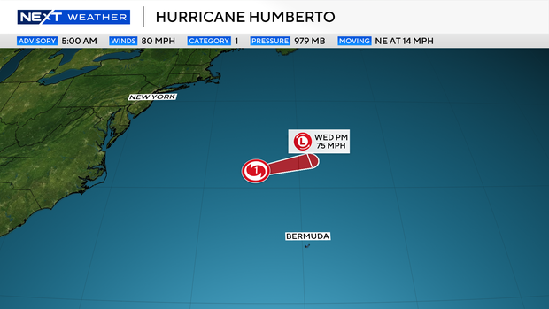
Humberto, the eighth named storm of the 2025 Atlantic hurricane season, quickly strengthened into a Category 5 hurricane on Saturday afternoon before weakening to a Category 2 on Tuesday, Sept. 30. However, it is not expected to impact South Florida, meteorologists say.
As of late 8 a.m. Tuesday, Humberto's center was about 375 miles south-southwest of Bermuda. It was moving northwest at about 14 mph with maximum sustained winds of 130 mph — barely a Category 4 — according to the NHC.
Humberto, will remain north of Bermuda as it then continues to move further east into the Atlantic.
2025 Atlantic hurricane season
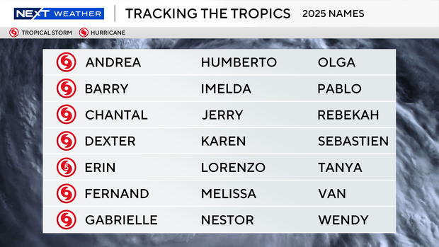
The National Oceanic and Atmospheric Administration, or NOAA, forecast an above-normal hurricane season this year, predicting there will be between 13 and 18 named storms. Five to nine of those are expected to become hurricanes.
Erin was the first, and so far only, storm to become a hurricane this season. Erin didn't make landfall, but at its peak grew to a ferocious Category 5, and it caused strong winds, dangerous rip currents and flooding along parts of the East Coast.
Historically, on average, hurricane and tropical storm activity peaks on Sept. 10, but this year has been quieter than expected when it comes to tropical systems in the Atlantic.