Florida fire map shows live updates on wildfires burning in Broward and Miami-Dade
A wildfire in the Everglades in western Broward has now been contained after burning thousands of acres and impacting air quality across parts of South Florida for days, according to the Florida Forest Service and other state and local agencies.
The fires are highlighted on Florida's Active Wildfire Points map, an interactive tool that tracks current wildfires across the state and provides updated information on acreage burned and containment levels. You can check it out here:
Max Road Fire in Broward
The largest blaze, known as the Max Road Fire, was burning west of U.S. 27 and Pines Boulevard in western Broward County. Officials said the fire has scorched more than 11,400 acres as of Wednesday and was "contained and controlled."
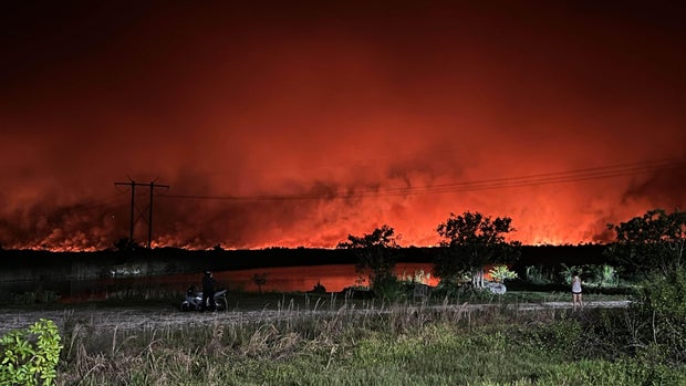
Florida City fire in Miami-Dade
A second wildfire, called the 172nd Avenue Fire, was burning near Florida City in southern Miami-Dade County. Officials said the fire has burned at least 315 acres as of Thursday and was 80% contained.
The 172nd Avenue Fire temporarily forced the closure of Card Sound Road and restricted access to the Florida Keys last weekend.
Florida dry season fuels wildfire risk
Florida is currently in its dry season, a period that typically runs from October through May and brings an increased risk of wildfires across the state.
According to the Florida Forest Service, peak wildfire season usually occurs during April, May and June, when dry vegetation, low humidity and windy conditions can help fires spread quickly.
The National Weather Service said ongoing drought conditions and low relative humidity have elevated wildfire danger across much of Florida in recent weeks. Officials are urging residents to avoid outdoor burning and remain alert as firefighters continue battling dozens of active wildfires statewide.