Cold Air Exits South Florida, Warming Trend Begins
MIAMI (CBSMiami) -- Warmer temperatures are on tap for the rest of the week but it is a gradual warm-up.
Not as chilly for Tuesday morning with inland temperatures falling to the mid and upper 50s and the low 60s along the coast.
At the same time, clouds are building while the wind turns out of the east and so this is helping to moderate temperatures back to normal.
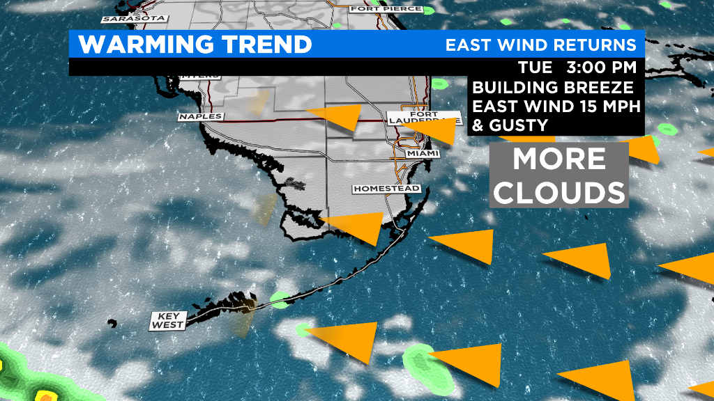
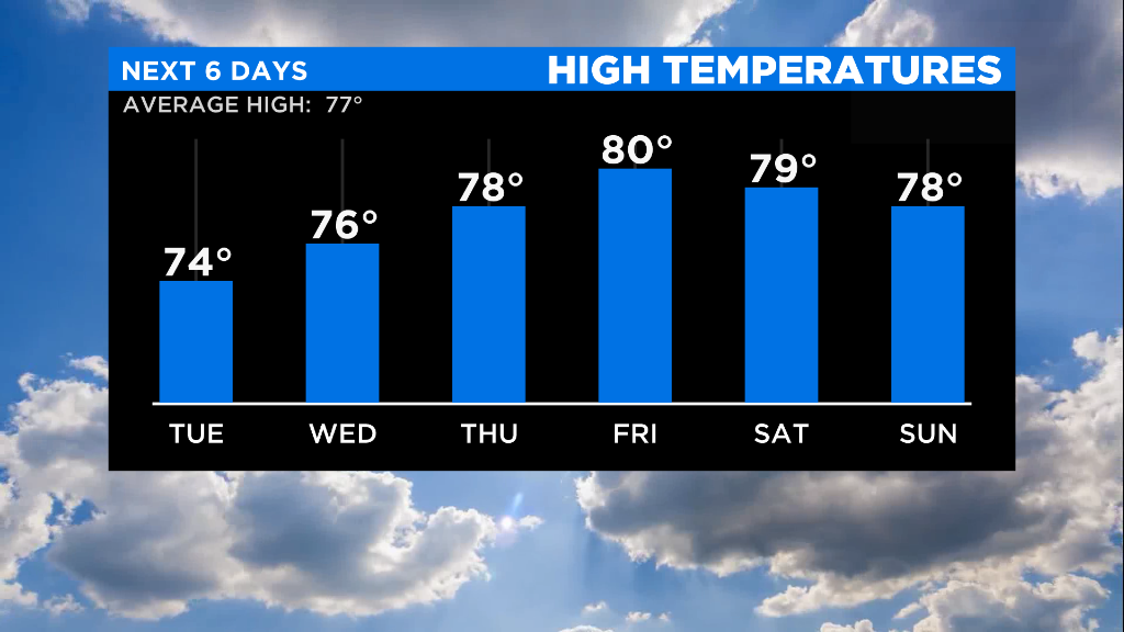
Speaking of the wind, that ocean breeze will become strong with gusts around 20 mph later in the afternoon on Tuesday as temperatures rise to 74 degrees.
Gusty winds between 25 to 30 mph are in the forecast by Wednesday and the windy conditions will last through Friday.
Afternoon highs will be warmer but seasonable in the mid 70s on Wednesday and then near or right at 80 degrees Thursday and Friday.
While the overnight lows will warm up to the upper 60s by Thursday morning.
When it comes to moisture, it will be on the rise this weekend but mainly dry conditions are expected to last before the weekend arrives.
For boaters, keep in mind that seas will be a bit choppy due to the stronger east wind so small craft advisories are possible.
The next cold front comes with uncertainty in the timing but for now, weather models are showing that the front is arriving during the weekend and could stall.
This means that the rain chance and humidity rises during Saturday and Sunday. Temperatures during the weekend will still be warm in the upper 70s for highs and lows in the upper 60s.