Los Angeles prepares for two rain systems as burn scar areas remain on edge for potential mudslides
The Los Angeles area is preparing for the tail end of an atmospheric river that will bring "beneficial rain," forecasters say.
Two storm systems are expected to bring some much-needed rain after the region battled several weeks of extremely dry conditions. The lack of rain and strong Santa Ana winds helped fuel the wildfires that ravaged the Pacific Palisades and Altadena communities.
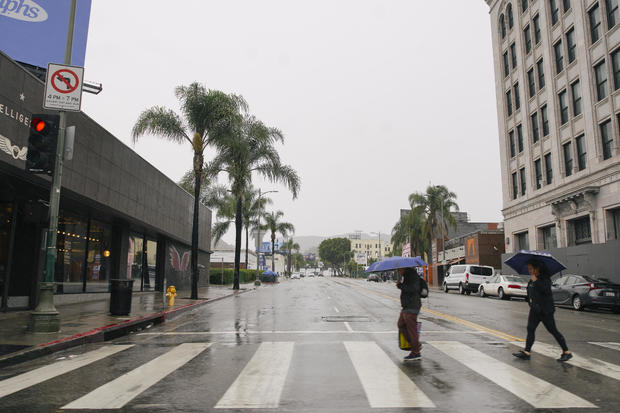
The National Weather Service said clouds will develop throughout the day and temperatures will begin to drop. Rain will be overspread through the area into the overnight hours.
The NWS said Los Angeles and Ventura counties could receive between .5 and .75 inches of rain Tuesday through Wednesday, with the mountains and hills getting between .75 and 1.5 inches of rain.
"For LA/Ventura Counties, rain rates and totals are expected to be significantly lower and chances remain under 5% for rates to exceed USGS thresholds over the recent burn scars," the NWS said.
KCAL News Meteorologist Paul Deanno said the burn scar areas will be monitored closely for the potential of debris flows and mudslides, but the risk looks small.
The NWS issued a wind advisory for Ventura County, which will go into effect at 4 p.m. Tuesday and remain until 3 a.m. Wednesday. South winds are expected to reach 20 to 30 mph with gusts up to 50 mph.
The second storm will begin Thursday evening with steady rain into Friday morning, KCAL News Meteorologist Amber Lee said. There will be a break between the two systems.
Forecasters are not confident about the amount of rain the second storm with bring since it is further away in time and distance.
Deanno explained the region is in a 6 inches rain deficit for the water year, which begins on Oct. 1. The two rainstorms will help make up a small amount of that deficit but receiving too much at once could cause widespread flooding.
Even though Southern California needs rain, the NWS said it doesn't seem like the two systems will produce enough rain to completely end the high fire season.
Lee said rain will wrap up around Friday afternoon and conditions will be dry through the weekend.
Storm preparations
Ahead of the rain, crews with the Los Angeles County Department of Public Works cleaned drainage facilities and debris basins, installed additional K-rails near homes and laid out over 1,500 sandbags in targeted locations.
"Los Angeles County has been working around the clock to prepare for this storm, clearing debris basins, reinforcing infrastructure, and making sure our residents have the resources they need to stay safe," L.A. County Supervisor Lindsey Horvath said.
Crews from the California Conservation Corps laid out compost silk socks, anchored in place by bags of gravel, to filter contaminates from washing into storm drains and into the watershed.
On Tuesday afternoon, Pacific Coast Highway in the Malibu area will close once again in anticipation of rain and potential mudslides. It had just reopened Monday morning. The California Department of Transportation said the roadway will close at 3 p.m. to all but essential workers. It will shut down between Chautauqua Boulevard in Los Angeles and Carbon Beach Terrace in Malibu. The road is expected to remain closed until at least Friday.
Residents were asked to clear drainage paths around their properties, install sandbags to direct runoff away from homes, avoid travel in burn areas and mountain roads during heavy rainfall and sign up for emergency alerts at ready.lacounty.gov.


