Windy Friday with isolated evening storms, cooler by Sunday
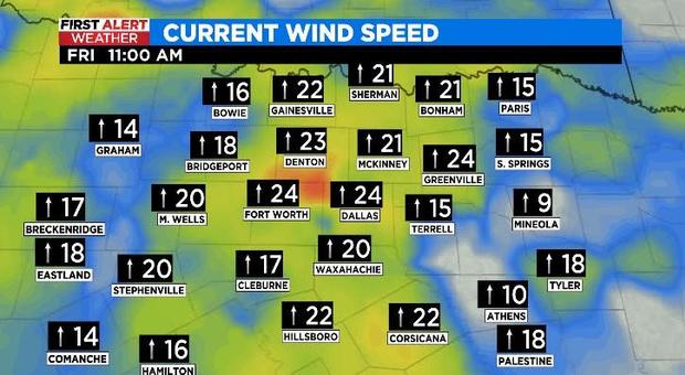
NORTH TEXAS (CBSDFW.COM) - Hold onto your hats (figuratively and literally) – winds are out of the south, currently sustained around 15 to 25 mph, and gusting to over 35 mph for parts of the Metroplex.
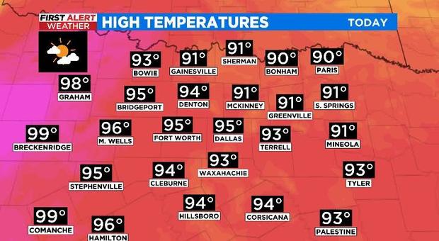
The conditions are just below Wind Advisory criteria but make no mistake it will be a gusty day. The blustery conditions will help (along with some sunshine) to get high temperatures into the mid 90s for most. Things will be a little warmer -- upper 90s and low 100s -- to the west.
It is hot and dry now but there are isolated storm chances this afternoon/evening. There are also parts of North Texas under a Level 2 "slight" risk for winds and hail.
The storms will be more widespread and stronger out to the west and up into Oklahoma as they develop along a dryline. When the potentially severe weather starts to move into North Texas the storms should be on a weakening trend. As it stands, not all weather models are in agreement on the system sustaining the journey into our region.
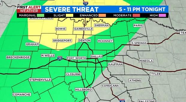
So, what are the chances? CBS 11 Meteorologists have coverage at 30% for tonight, so most areas won't see any rain. But don't fret if you've been hoping for some wet weather…there's plenty in the extended forecast.
A cold front arrives late Saturday and will bring a decent chance for rain (and a few stronger storms) to North Texas, especially Saturday evening. Cooler -- and this time really mean cooler -- temperatures are on slate for Sunday.

The unsettled pattern keeps the rain chances and the cooler temps around through the middle of next week. Dig out your umbrellas and take them with you next Monday.


