North Texas Expected To See Rain From Marco As 2 Storms Threaten Gulf Coast
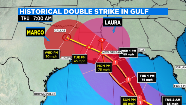
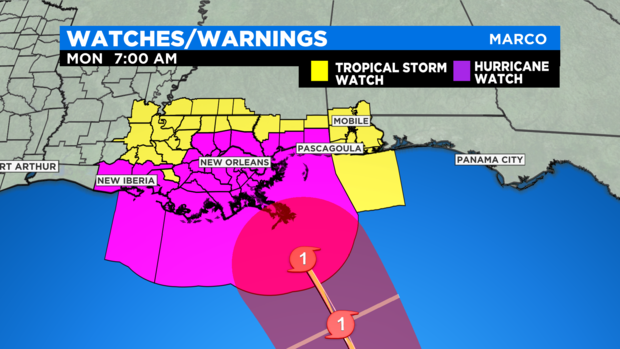
(CBSDFW.COM) - Starting Saturday afternoon the forecasted track for Tropical Storm Marco changed significantly. Now it's expected to land onshore in the Delta region of Louisiana, just south of New Orleans.
Hurricane force winds are expected in New Orleans on Monday along with 10 to 12 inches of rain. The storm is then forecast to move west and move into North Texas by Wednesday.
While North Texas is getting Marco rain, Tropical Storm Laura is forecast not only to strengthen to a Category 1 hurricane but to hit somewhere on the Delta a mere 48 hours behind Marco. Hurricane records go back before the Civil War and this has never happened before in the records.
The total rainfall that could occur could be catastrophic, especially when you consider that New Orleans sits below water level and relies on an extensive dike and pumping system to keep water out of the city. Ironically, this historical hurricane threat arrives just a few days away from the 15-year anniversary of Katrina, the deadliest and most expensive hurricane disaster in modern times.
Both Marco (Monday) and Laura (Wednesday) are expected to become at least Category 1 hurricanes. That would make seven landfalls of named storms in the U.S. before September, which also has never happened before.
The normal hurricane season produces 12 named storms. We are currently at 13 named storms with only 46% of the season completed. The halfway point is Sept. 1.
How much rain does North Texas get from Marco? The forecasts will vary greatly over the next few days as we draw closer to the event. Two hurricanes in the Gulf at the same time have thrown the forecast models in doubt. Please stay posted.