Fall temperatures have moved in; North Texas is cooler and will get cold this week
NORTH TEXAS (CBSDFW.COM) — Dramatic changes in the weather are in progress.
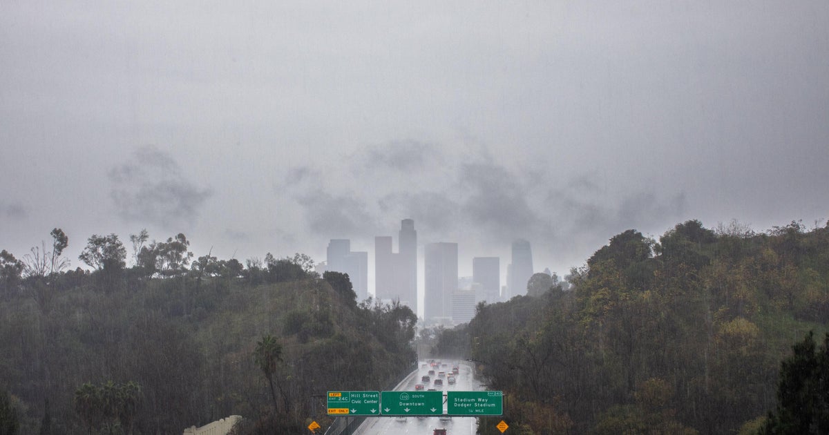
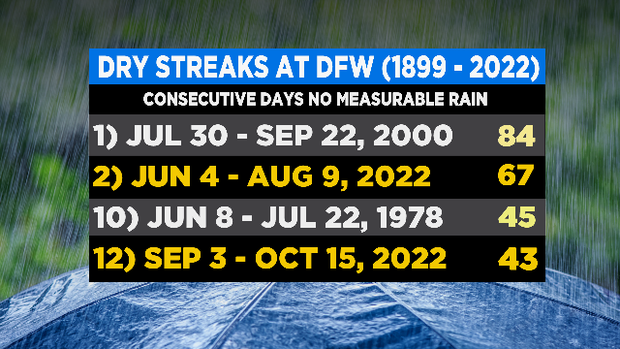
First off, it rained at DFW this morning. That's the first measurable rain at DFW since Sept. 2, 43 days ago. This has been the year of dry streaks; the 67-day streak this summer is the 2nd longest in the 123-year record. The one that ended this morning was the 12th longest streak.
After some heavy rain in our northern counties this morning, we are expecting some heavy rain to fall in the Metroplex and in our southern half this afternoon. Several rounds are expected to move in from the west, they could have gusty winds and pea-sized hail with the stronger storms.
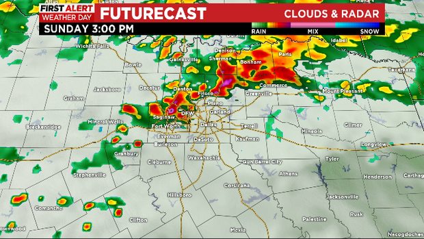
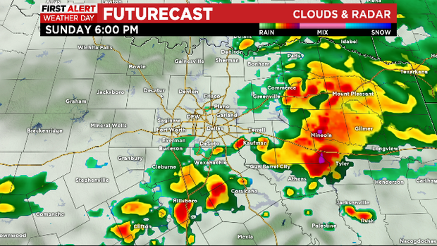
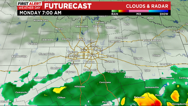
Activity will diminish overnight. We'll keep rain in the forecast for tomorrow morning. Most of Monday's rain will fall along I-20 and south.
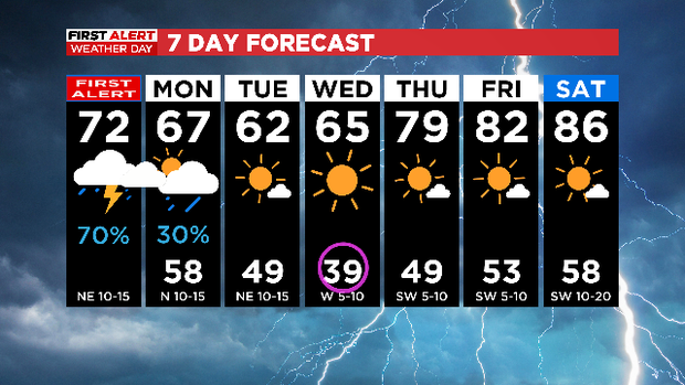
There has been a dramatic drop in temperatures. We've spent the morning with brisk north winds and in the 60s. This afternoon we'll only warm into the low 70s. Yesterday we got within one degree of tying a record high for the day. Tomorrow we'll be in the 60s all day.
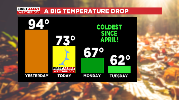
So break out your fall jackets and bring in all your tropical plants. Brace for a 55° degree temperature swing.
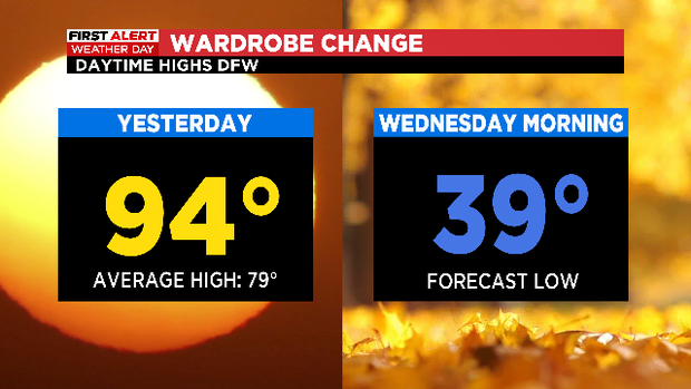
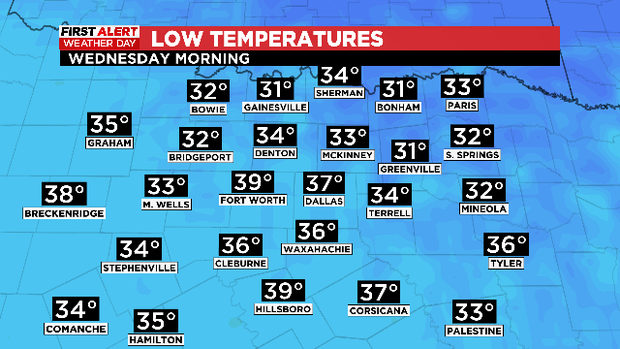
Yes, we are forecasting lows reaching down INTO THE 30s WEDNESDAY MORNING. Frost on the pumpkins!
Alas, even the chill of fall won't hold for long. By next weekend we'll be right back into the upper 80s. There is a good chance however, that yesterday was the end of 90-degree days at DFW for the year. Hopefully.