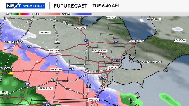
Wintry mix moves into Southeast Michigan on Tuesday

A wintry mix is in the forecast for Tuesday in Southeast Michigan.
Areas closest to the Michigan/Ohio border will be most likely to see the wintry mix. Areas further north will begin the day with snow. Afternoon highs will reach above freezing, changing from snow to rain. Those living south of I-69 are most likely to see the precipitation.
Precipitation will move out in the evening, leaving Southeast Michigan with dry conditions until Thursday afternoon.
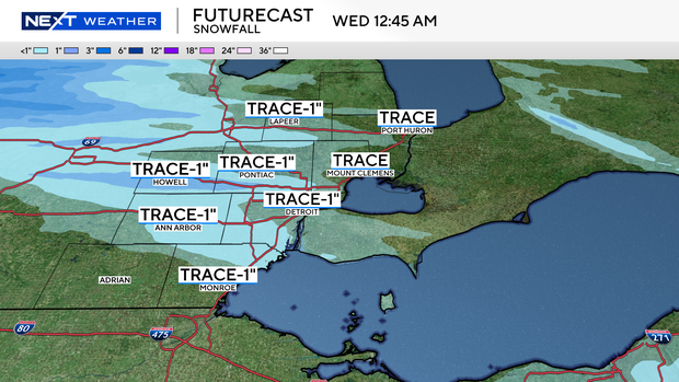
Accumulations will be minimal. We can expect less than 1 inch of snow accumulation. Roads will be wet and could be slick.
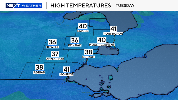
Temperatures will be below average. Lows will begin the morning in the mid- to upper-20s and warm into the mid- to upper-30s for highs on Tuesday afternoon.
For the latest NEXT Weather forecast, watch online, on air, or streaming on CBS News Detroit and Pluto TV.