Hail, damaging winds possible late Monday, all day Tuesday for Southeast Michigan


Southeast Michigan will see an increasingly severe weather threat from Monday night into Tuesday, starting with warming temperatures in the 60s and 70s across the area.
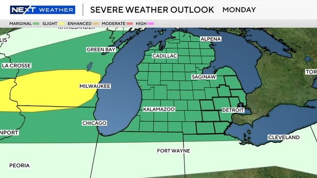
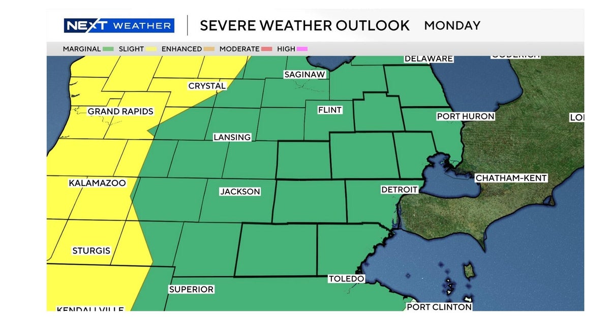
Monday's weather
A marginal risk (level 1/5) is in place for Monday night, meaning only isolated severe storms are expected, mainly after 7 p.m. through midnight. The primary threats will be hail around 1 inch and a few localized damaging wind gusts, with storms moving quickly west to east, with storm coverage remaining limited.
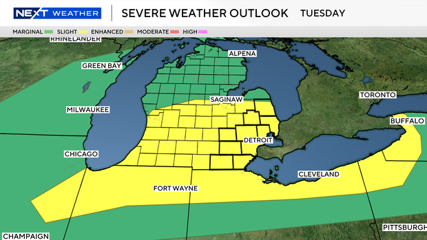
Tuesday's weather
By contrast, Tuesday brings a Weather Alert Day with a slight risk (level 2/5), indicating a higher chance of more organized and scattered severe storms through the day as a cold front moves through.
On Tuesday, all severe weather hazards are possible, including damaging winds (potentially 60+ mph), large hail, heavy rainfall, and even a low risk of tornadoes, with damaging winds expected to be the main concern.
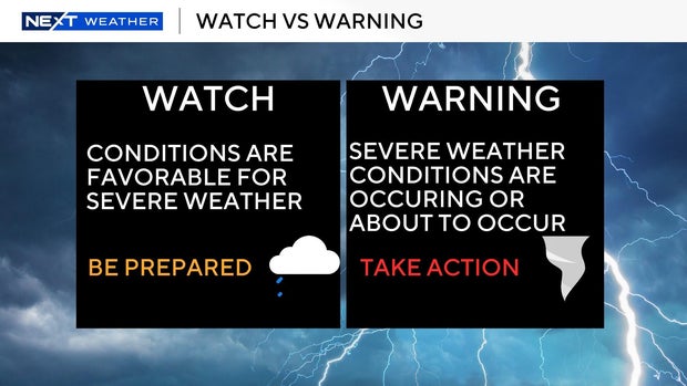
Watch vs. warning
The National Weather Service says a severe weather watch means "be prepared." It is possible that the weather will reach severe levels during the time frame specified.
A severe weather warning means "take action," that severe weather conditions have been reported by spotters or can be detected on radar. People are asked to take shelter indoors, away from windows.
It is possible for a tornado warning to be issued without a tornado watch already in effect. This is the scenario that happened in Southwest Michigan on March 6, 2026.