Winter weather expected in SE Michigan during Tuesday and Wednesday

This week is an active one for Southeast Michigan weather with multiple rounds of snow and even rain expected for mid-week.
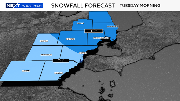
Our first clipper aimed for the region early Tuesday morning. Snowfall amounts were expected to be light somewhat like Sunday morning.
We then slowly warm through the day with our high temperatures not reached until after 11 p.m. Tuesday.
The second system arrives after 9 p.m. Tuesday as we continue to slowly warm.
Precipitation will begin as snow and will be more of the normal snow type, slowly turning into the slushy snowfall by Wednesday morning. Snow amounts vary greatly and are likely to be changed a bit as we get closer to Tuesday night.
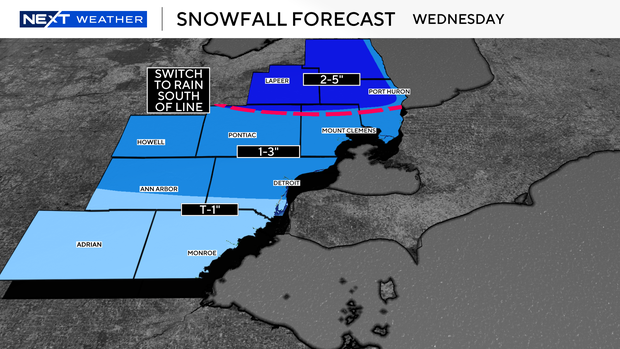
Depending on the time we switch to rainfall, the snow amounts could end up at the bottom or top of our forecast ranges.
As temperatures fall through the afternoon on Wednesday, wet roads and slush will re-freeze that night, leading to some slick travel on untreated roads.
Stay with the NEXT Weather team for updates as the system evolves.