Thunderstorms, downbursts, small hail possible for Metro Detroit on Tuesday


Most of Metro Detroit is included in a marginal risk area for severe thunderstorms on Tuesday.
A marginal risk issued by the National Weather Service Storm Prediction Center is a level 1 out of 5 for the chances of severe weather. That zone on Tuesday morning includes Southern Lower Michigan from about Interstate 69 and south into the Ohio and Indiana borders.
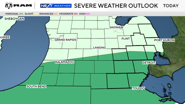
There are two times to watch for thunderstorms, one in the morning and the other late afternoon and early evening as a cold front moves through.
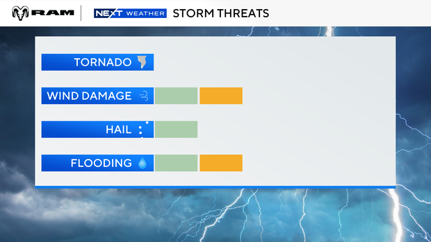
Most storms should remain below severe limits, but an isolated stronger storm could produce damaging wind gusts/downbursts, with small to near-severe hail possible. Heavy rainfall may be the more widespread concern, especially where storms move repeatedly over the same areas.
Watch vs warning
The National Weather Service says a severe weather watch means "be prepared." It is possible that the weather will reach severe levels during the time frame specified.
A severe weather warning means "take action," that severe weather conditions have been reported by spotters or can be detected on radar. People are asked to take shelter indoors, away from windows.
Driving during heavy rains
"Wet pavement can turn roads into a slip and slide in seconds," said Adrienne Woodland, spokeswoman for AAA-The Auto Club Group. "Make sure your vehicle is ready for changing weather, and when the rain starts falling, adjust immediately. Slow down, give yourself space, and stay alert because conditions can turn bad fast."
When visibility drops while driving, AAA says to:
- Pull off the road safely if you can't see ahead.
- Exit the interstate rather than stopping on the shoulders.
- Do not drive with your vehicle's hazard lights activated.


