Strong winds Monday in Southeast Michigan; dangerous windchills Tuesday morning

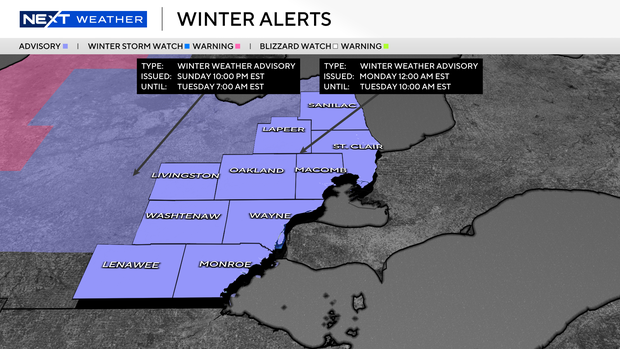
A winter weather advisory will be in effect from 12 a.m. on Monday to 10 a.m. on Tuesday for all of Southeast Michigan.
The NEXT Weather team has designated both Monday and Tuesday as NEXT Weather Alert Days.
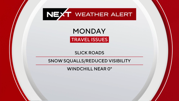
Widespread light snow overnight Sunday will contribute to slick road conditions on Monday. Temperatures will drop throughout the day, with windchill temperatures near zero for most of the day.
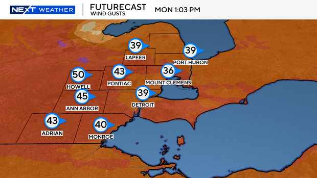
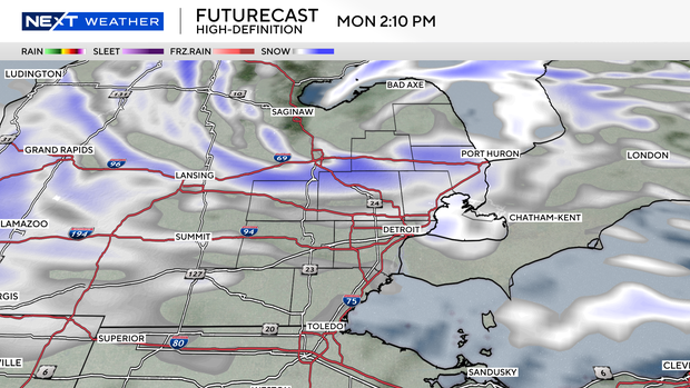
Sustained winds of 15 to 25 mph from the west will bring lake effect snow to the area, with snow squalls possible, especially from 11 a.m. to 5 p.m., when gusts may surpass 40 mph. Accumulations of up to a half inch have been observed within these snow squalls.
Snow squalls can lead to sudden whiteouts, reduced visibility and rapid deterioration of road conditions.
Temperatures will continue to drop Monday night, with the coldest windchills ranging from minus 5 to minus 15 expected between 10 p.m. Monday and 10 a.m. Tuesday. The coldest readings are expected near the Ohio border and across the thumb.

Dress in layers, cover all exposed skin and limit time outdoors to avoid frostbite.
Detroit Rescue Mission Ministries said in a statement on Sunday that it is offering space for 100 people in its warming centers in Metro Detroit during the cold weather, in addition to the roughly 2,400 people who stay in its eight shelters each day. Learn more about the warming centers here.
There's more snow and arctic air on the way, so be sure to check with CBS News Detroit for the latest conditions.


