Cheboygan River levels only 7.6 inches away from top of dam, state officials say

Conditions near the Cheboygan Lock and Dam in Northern Lower Michigan continue to worsen, with the river levels just 7.68 inches below the top of the dam as of 7 a.m. Tuesday, state officials said.
A chart with the latest reading is part of the Michigan Emergency Management and Homeland Security special webpage on the increasingly dire situation along the Cheboygan River. To compare, the water levels were at 13.75 inches below the dam at 7 a.m. Monday.
Snowmelt from a mid-March winter storm, aggravated by recent rains, has pushed the river level high, with other communities in Northern Lower Michigan struggling with washed-out roads and a closed regional airport.
State officials issued their first alert of the rising waters on April 7, with the water at 21.5 inches below the top of the dam at that point.
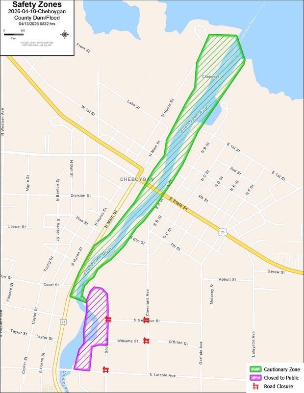
Residents of Cheboygan were given a "ready" alert on Monday to prepare for possible evacuations because water had reached within 12 inches of the top of the dam. If water reaches 6 inches within the top of the dam, state officials say, a "set" alert will be issued. A "go" alert will be issued if water is within an inch of the top of the dam, with a high probability of topping the dam or a dam failure.
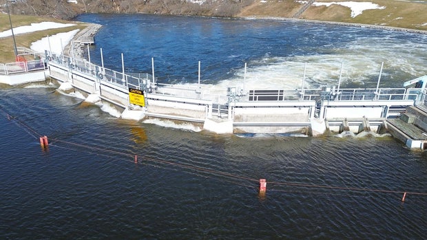
Michigan Gov. Gretchen Whitmer issued a State of Emergency on Friday over the Cheboygan Dam circumstances, with state and local officials taking precautions with sandbags, closing a nearby state highway bridge to traffic and determining logistics for clearing water as fast as possible through the river.
There are numerous local street closings in the area because of flooded roads.
"Emergency crews are actively monitoring conditions and do not have enough signage to mark all the locations," the Cheboygan County Sheriff's Office said Tuesday morning.
The above video originally aired on April 13, 2026.


