Jet stream-charged downslope winds hammer Colorado's Front Range with more on the way; see highest recorded gusts

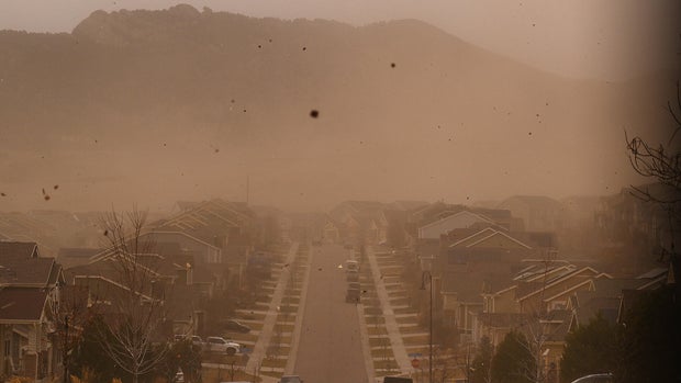
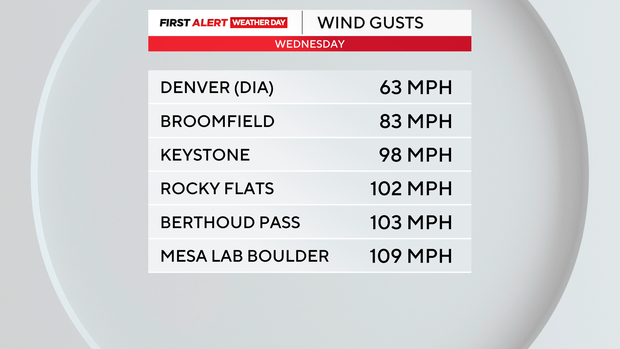
Jet stream-charged downslope winds battered Colorado's northern Front Range Wednesday. Some wind gusts reached the strength of a category 2 hurricane. The strongest gust by Wednesday evening was a 109 mph burst at NCAR'S Mesa Lab near Boulder.
Other areas above 100 mph included places like Berthoud Pass and Rocky Flats.
Wednesday's strong winds downed power lines and caused some damage to cars. Some highways close to the foothills were shut down and the conditions resulted in delayed flights at Denver International Airport. There were also power outages in place -- primarily for safety reasons -- for more than 100,000 Coloradans.
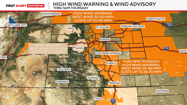
Wind will continue to be strong in the mountains and Eastern Plains overnight Wednesday into Thursday with a high wind warning remaining in place.
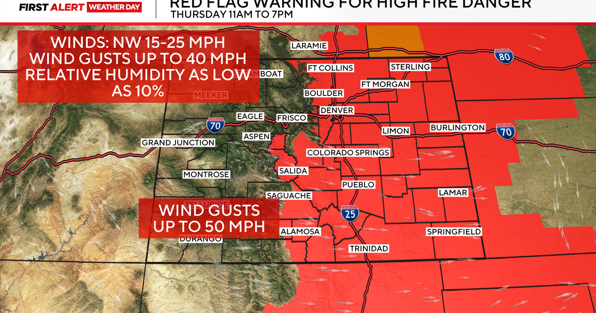
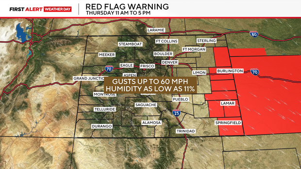
A red flag warning is in place for extreme eastern Colorado on Thursday.
Strong winds will be back Thursday into Friday with another round of damaging winds, dry conditions and warm temperatures. There is a Fire Weather Watch posted for the Denver Metro Area and the Front Range Foothills Thursday night into Friday. Wind gusts along and east of I-25 may reach 60 mph.
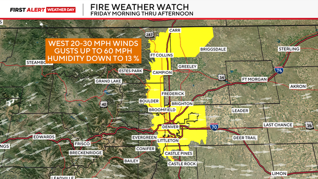
Along with that a High Wind Watch for the northern Front Range Foothills and Mountains for the same period.
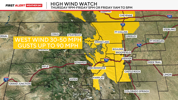
Wind gusts are expected once again to be as high as 90 mph in some spots.