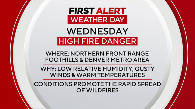
High winds and critical fire danger expected in Colorado Wednesday along the Front Range

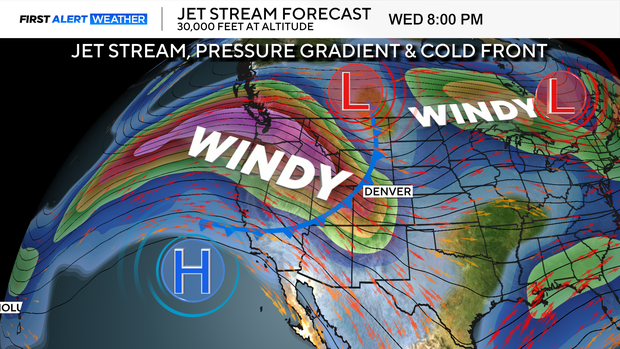
A First Alert Weather Day has been issued for Wednesday, for powerful winds and dangerous fire conditions. A strong jet stream, pressure gradient and cold front will dramatically, change our mid-week weather pattern.
The triple threat of low relative humidity, gusty winds and unseasonably warm temperatures will create dangerous wildfire conditions from the foothills out across the Eastern Plains.
The National Weather Service has issued a high wind warning for the mountains, foothills and much of the I-25 corridor on Wednesday. Wind gusts could reach 60 to 90 mph, with the strongest winds expected near the base of the foothills.

At the same time, a red flag warning is in effect for the Denver metro area, the Palmer Divide and much of the urban corridor starting at 11 a.m. Wednesday. Extremely dry air combined with strong downslope winds could allow any fire that starts to spread rapidly. Wind gusts could kick up to 80 mph in the Denver metro area.
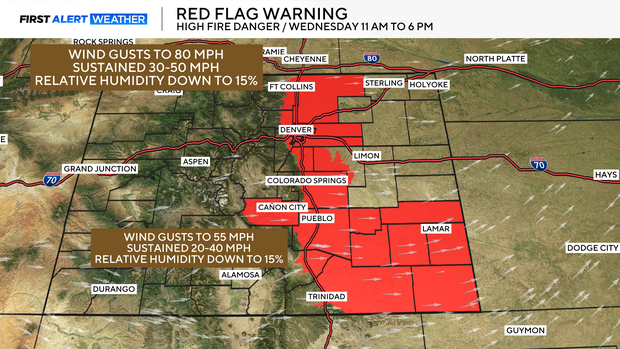
Wednesday will stay unseasonably warm and dry. High temperatures are expected to climb into the mid to upper 60s -- nearly 15 to 20 degrees above normal for mid-December. While the weather will feel pleasant, the warm and dry conditions will help set the stage for heightened fire danger.
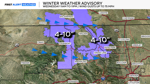
Travel conditions in the mountains are expected to deteriorate Wednesday afternoon and overnight. Strong winds combined with periods of snowfall could lead to blowing snow and slick roads, particularly over mountain passes. There is a Winter Weather Advisory posted for 11 a.m. to 11 p.m. on Wednesday. Some of our northern mountains may see 4 to 10 inches of snow along with 75 mph wind gusts.
Winds will gradually decrease late Wednesday night into Thursday, though breezy conditions may linger into Thursday morning on the plains. Cooler air will move in behind a cold front, bringing temperatures closer to seasonal averages on Thursday.
Looking ahead, strong winds are expected to return Friday, once again raising fire weather concerns across the Front Range and foothills. Conditions finally begin to calm down this weekend, with lighter winds and a return of mountain snow showers by Saturday. Accumulations look lighter overall, but travel impacts are still possible at higher elevations.