What's next for Colorado's weather after our near-record heat Thursday

One more day of scorching summer heat is gripping the Front Range, but a major pattern shift is on the horizon — bringing cooler temperatures, increased rain chances, and the potential for strong storms starting Friday.
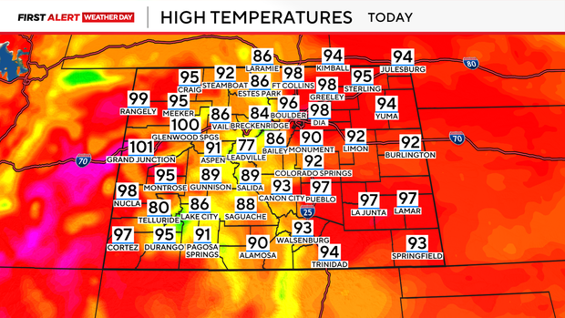
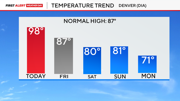
Highs across the plains Thursday are expected to climb into the mid to upper 90s, with Denver possibly approaching its record high of 99° for this date, set back in 2023. An upper-level high remains parked over the region, keeping conditions hot and dry with only a slim chance of a mountain thunderstorm drifting off the higher terrain late in the day. But relief is on the way. A cold front will sweep into the state early Friday, ushering in a significant cooldown and a surge in moisture.
That combination will help fuel a better chance for afternoon and evening thunderstorms each day through the weekend and next week.
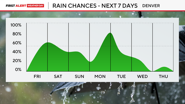
Daily chances of storms will continue through the weekend, especially Saturday and Sunday. As the pattern shifts, daytime highs could drop significantly — possibly staying in the low 70s on Monday and Tuesday.