Very large hail possible in Colorado as severe storms threaten Front Range, Eastern Plains

Colorado's biggest severe weather threat on Tuesday is hail and not just small hail.
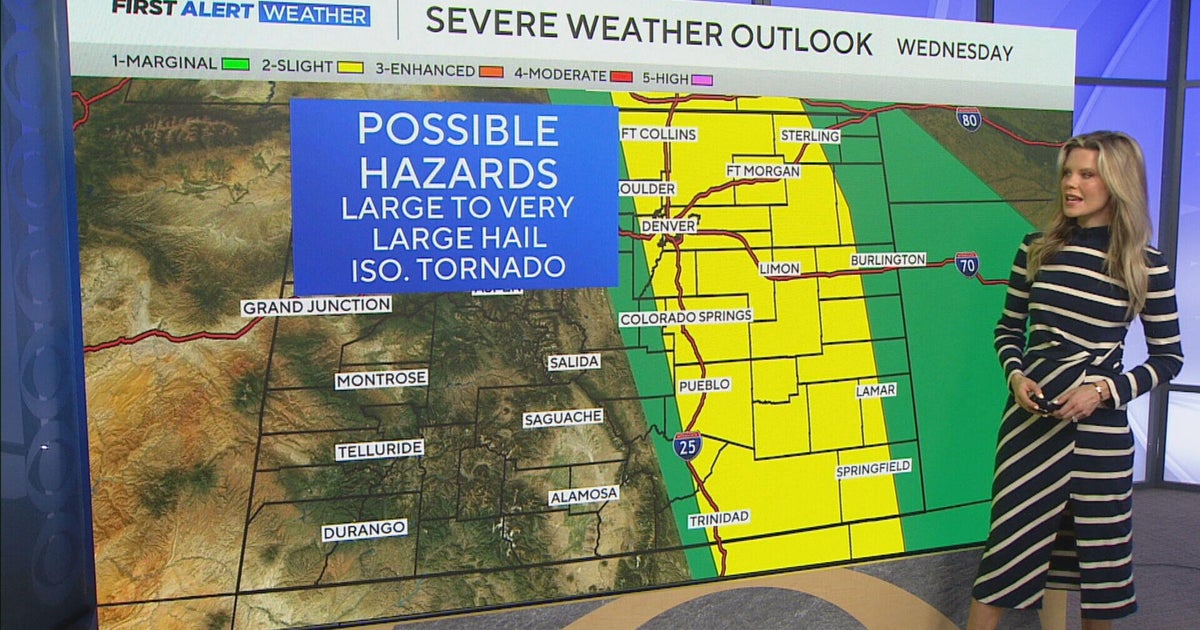
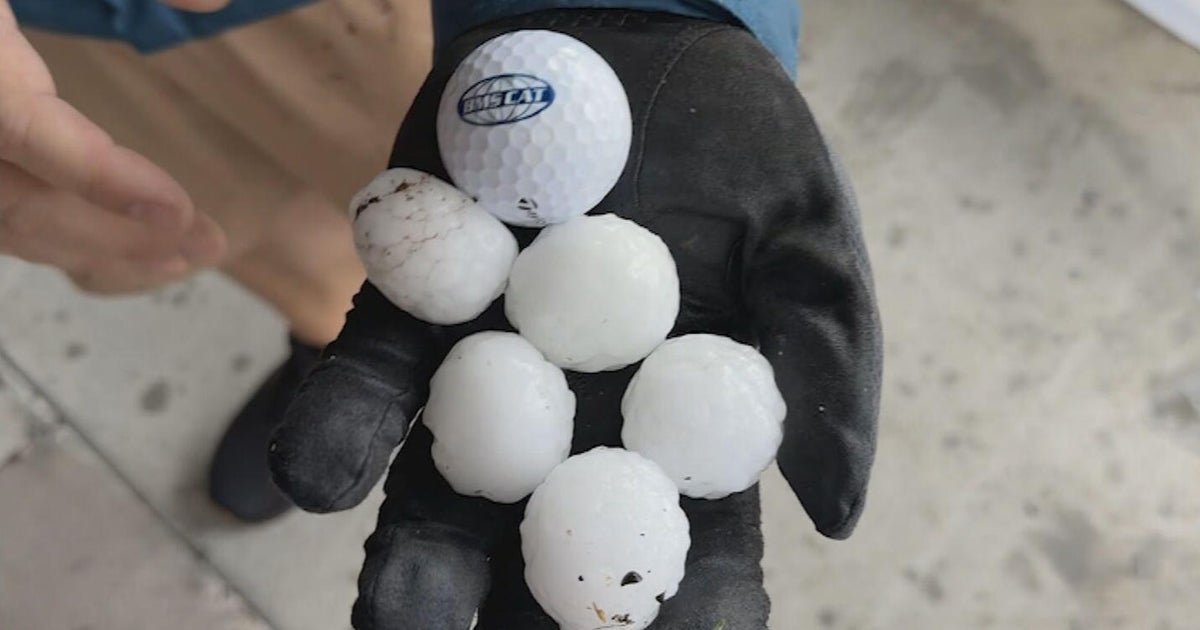
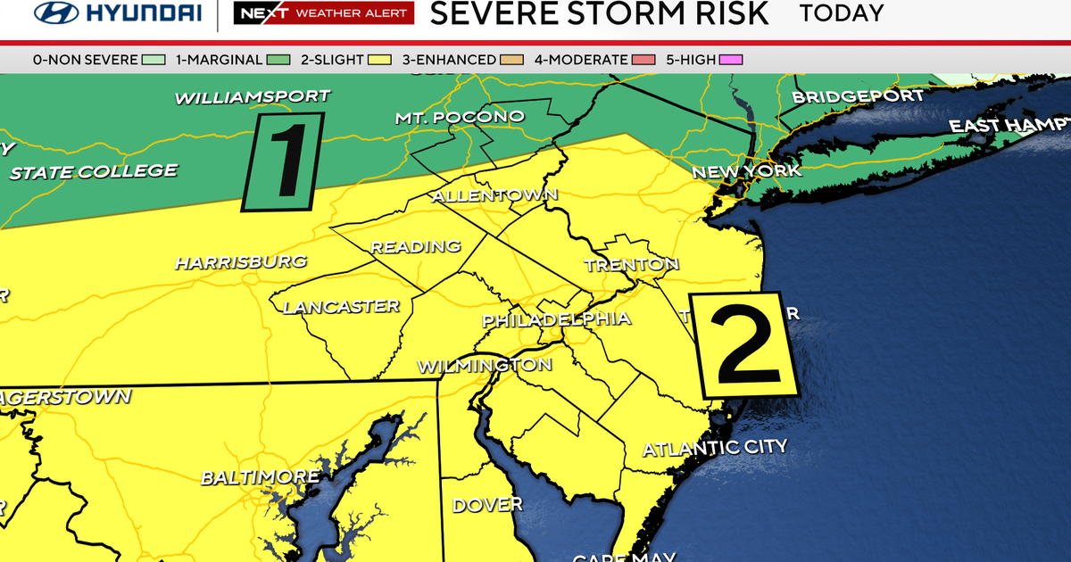
Parts of the Front Range and Eastern Plains are under an Enhanced Risk for severe weather, where the strongest storms could produce hail larger than 2 inches in diameter. A few storms may be capable of producing 2- to 3-inch hailstones, which is roughly tennis ball to baseball size.
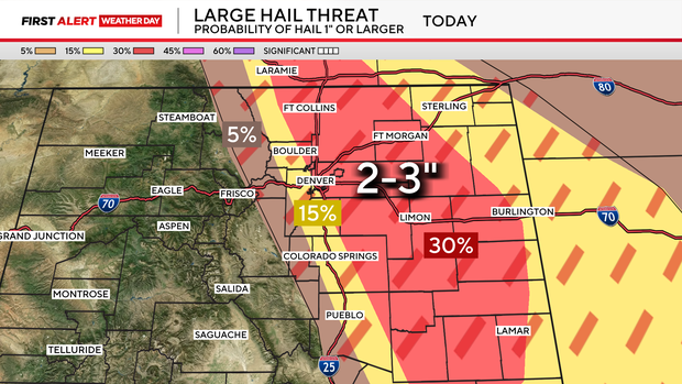
Hail that large can damage vehicles, roofs, windows, and crops.
This is a conditional severe weather setup. That means not everyone will see a storm, but any storm that does form could become severe quickly.
A few storms may first develop near the Front Range late Tuesday afternoon. The better severe weather window for the Denver metro area and northeast plains appears to be Tuesday evening into Tuesday night. Farther south, including Colorado Springs and Pueblo, the severe threat may last later Tuesday night as storms move southeast across the plains.
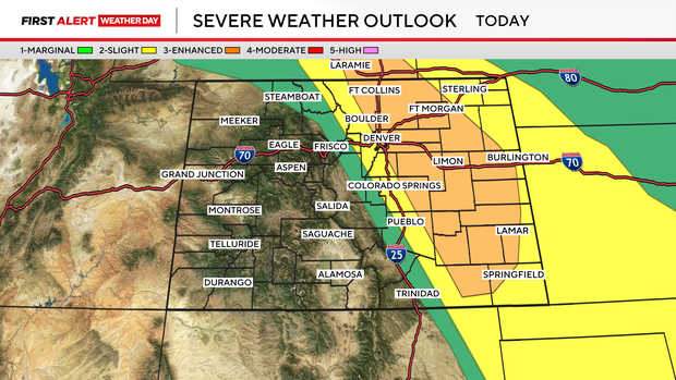
Denver, Boulder, Fort Collins, Greeley, Castle Rock, Colorado Springs, Pueblo, Limon, Fort Morgan, Sterling, Burlington, and Lamar are all included in some level of severe weather risk.
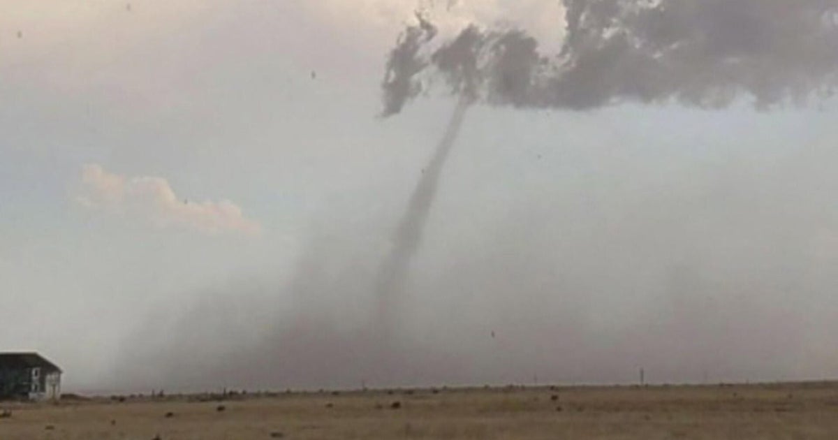
The hail threat is higher than the tornado threat, but the tornado risk is not zero. An isolated tornado could occur with any sustained supercell.
More rounds of strong to severe storms are possible on Wednesday and Thursday across Colorado's lower elevations. With several days of storms and deeper moisture moving in, the flash flooding threat will also increase, especially in areas that receive repeated rounds of heavy rain.