Snow showers, chilly temps across Denver metro area for First Alert Weather Day

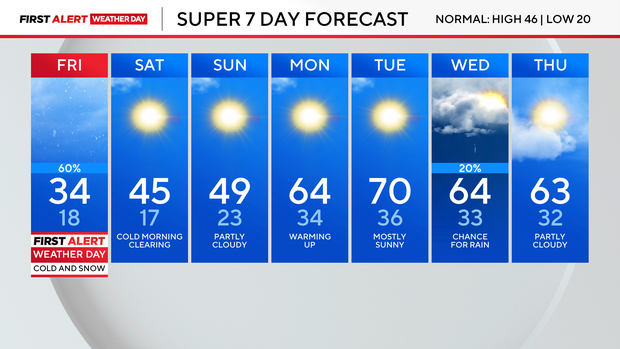
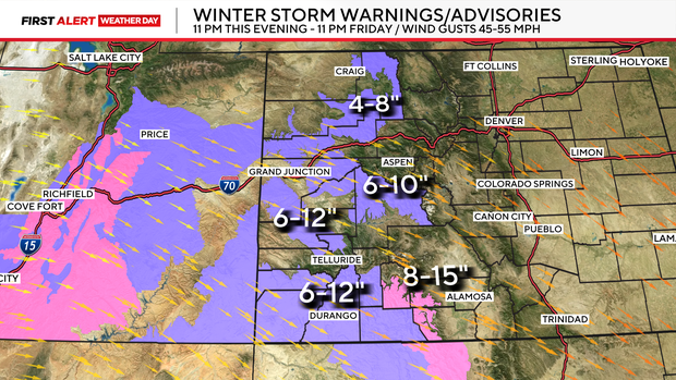
Scattered light snow showers and chilly temperatures are expected across the Denver metro area and Eastern Plains on Friday, prompting a First Alert Weather Day.
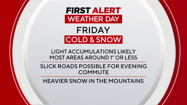
Most locations are expected to receive an inch or less, but brief heavier bursts could reduce visibility and create slick road conditions during the evening commute.
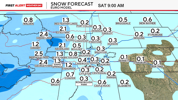
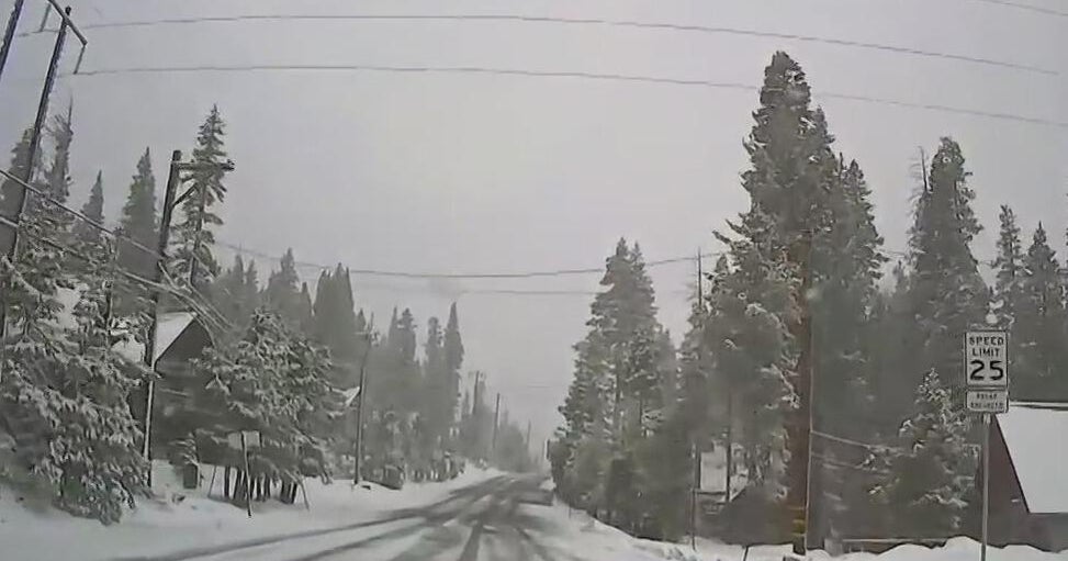
In the mountains, snowfall will generally remain on the lighter side as well, though snow will be more persistent through early Saturday. Travelers over higher passes should be prepared for winter driving conditions at times. Winter Weather Advisories and Winter Storm Warnings remain in place through Friday night.
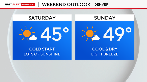
Snow chances will gradually decrease Friday night as the system pushes east of the area. Behind the system, drier air moves in Saturday with only a slight chance of additional snow showers in the mountains on Saturday morning. High temperatures will be near seasonal averages. A cold front may slide across the plains late Saturday into early Sunday, keeping highs in the 30s across far northeastern Colorado Sunday afternoon. Areas closer to the Front Range should see temperatures closer to normal.
A noticeable pattern change arrives on Monday and Tuesday. Westerly flow and developing downslope winds will allow temperatures to climb well above seasonal averages across the foothills and plains. It will also turn breezier in the higher terrain. Looking ahead to midweek, another upper-level trough could bring a chance of mountain snow and a slight chance of showers to the plains by Wednesday.