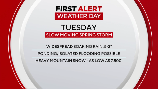
Slow-moving storm brings heavy rain and snow to Colorado on this First Alert Weather Day

Rain showers arrived for some in Colorado late Monday evening, but the heavy precipitation is now settling in across the state and will continue all afternoon.
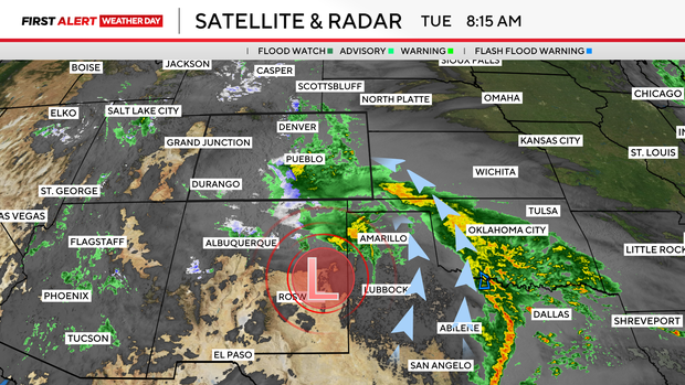
Several factors are at play in the low-pressure system bringing this precipitation, but because of its more southerly track, forecast rainfall totals have decreased slightly on Tuesday.
Tuesday is another First Alert Weather Day because of the impacts this slow-moving storm system will bring.
We are still expecting widespread soaking rain across the I-25 corridor, extending into the plains, but totals for the Denver metro have dropped slightly.
This heavy rain could lead to ponding and some isolated flooding this afternoon as rain builds.
While rain falls, heavily at times, in the lower elevations, the high country is bracing for the potential for more than 1 ft of snow in some areas.
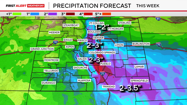
Most of the Denver metro area is expecting .5" to 1" of rain, with higher totals toward the foothills and in the west metro.
More rain will fall in southern Colorado, where totals could exceed 3 inches.
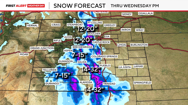
Snow will pile up this afternoon in the mountains, dropping to 8000 ft. throughout the day. More than 10-20 inches is expected over our highest elevations, with sharper gradients of snowfall as elevations drop.
Heavier rain turns to showers late Tuesday night and overnight.
By Wednesday, off-and-on showers and isolated storms will continue as this system clears out of the area.