Rainstorm moving through Colorado produces rare March cold-air funnel cloud near Sterling
Much needed rain brought cooler temperatures across Colorado's Front Range and northeastern plains on Tuesday. The sudden shift in weather patterns also produced a weak cold-air funnel cloud, much earlier in the season than usual.
Temperatures in Denver dropped from a high of 70 on Monday to 46 on Tuesday. The turbulent weather created a funnel cloud near the City of Sterling around 3 p.m, which a local rancher captured on camera.
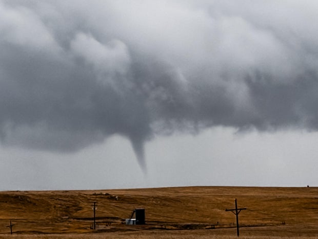
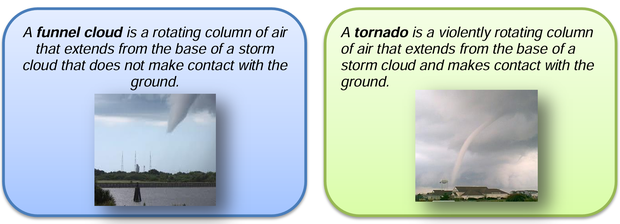
Although they are similar, a cold-air funnel cloud is not a tornado. Cold air funnels, like the one seen outside of Sterling, form beneath weak thunderstorms or showers when the air above is especially cold. The National Weather Service says cold air funnels are usually harmless but can possibly touch down as an EF-0.
In contrast, a tornado is created when a violently rotating column of air forms, extending all the way from the base of the storm cloud to the ground. They're formed by the same convective air currents that create funnel clouds, but are much stronger and more destructive.
It's rare to see these phenomena this early in the year, though not unheard of.
According to the NWS, "The threat of tornadoes in Colorado increases rapidly in May and continues through August. Ninety percent of Colorado tornadoes occur during this four month period, but tornadoes have been reported as early as February and as late as October."
A warmer-than-average storm system caused convective lift on Tuesday, creating springline storm conditions.