First fall storm in Colorado to bring deep mountain snow, heavy rain for Denver


Fall is bringing in a blast of cold temperatures in Colorado, plus heavy rain and significant mountain snow, prompting the first Winter Weather Advisory of the season for the Northern Front Range mountains.
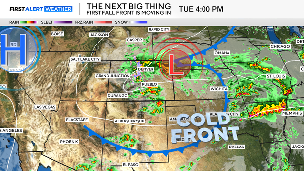
Tuesday is a First Alert Weather Day for drenching Denver rain and the heavy mountain snow. Fall arrived at 12:19 p.m. on Monday afternoon and, right on cue, the first storm system of the season blasted into the Rocky Mountain region.
The leading edge of the cool and wet weather change pushed through eastern Colorado late on Monday afternoon bringing in soaking rain showers and thunderstorms from the mountains across the plains.
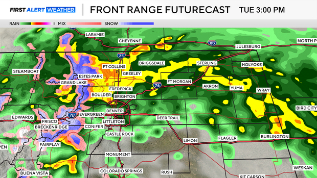
Tuesday will begin with mountain snow and rain showers over extreme northern Colorado. By noon, a surge of moisture, cool air and upslope will slam into the Front Range, bringing in significant accumulations of rain and mountain snow.
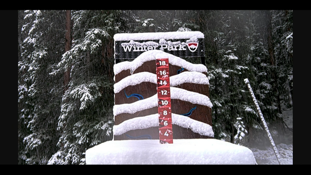
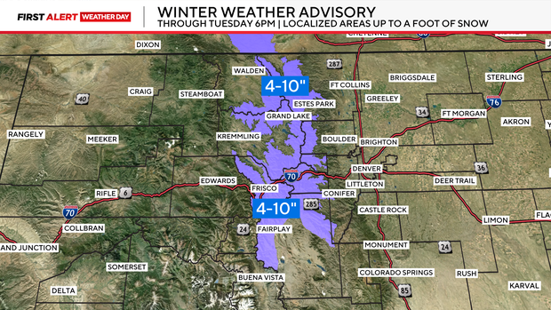
The Winter Weather Advisory is posted through Tuesday evening for Colorado's northern Front Range mountains. Snow amounts on average will range from 4 to 10 inches of slushy, wet snow above 9,000 feet. There will be a few isolated spots above 12,000 feet that may see a foot of snow or maybe a little more by Wednesday morning.
The Denver metro area and Eastern Plains will see copious amounts of rain into late Tuesday night. The heaviest rain will fall from noon through 7 p.m. on Tuesday.
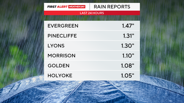
Rainfall amounts from Monday through early Tuesday morning have already stacked up to more than an inch of rain in some areas of Denver and the Eastern Plains. Through Wednesday morning up to 2.5 inches of rain will be possible in some areas of Denver and the surrounding suburbs.
As a result of the moisture, Rocky Mountain National Park on Monday evening closed Trail Ridge Road.
The storm is a fast mover. By Wednesday, the storm will clear the Rockies and a warming and drying trend will take over running all the way into the weekend.