First Alert Weather Days: Extreme fire danger Saturday, then wind, cold and snow for Colorado Sunday

A dramatic weather shift is unfolding across Colorado this weekend, prompting First Alert Weather Days for both Saturday and Sunday.
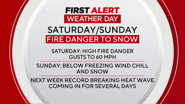
Saturday brings dangerous fire weather conditions, while Sunday flips the script with strong winds, sharply colder temperatures and periods of snow across the Front Range and mountains.
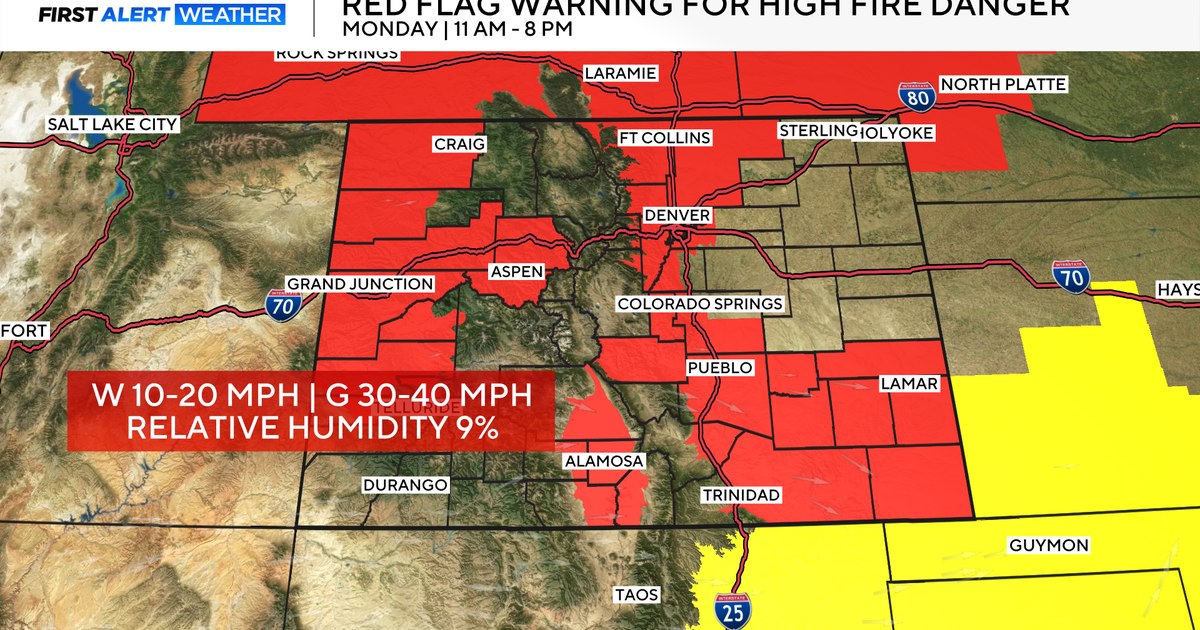
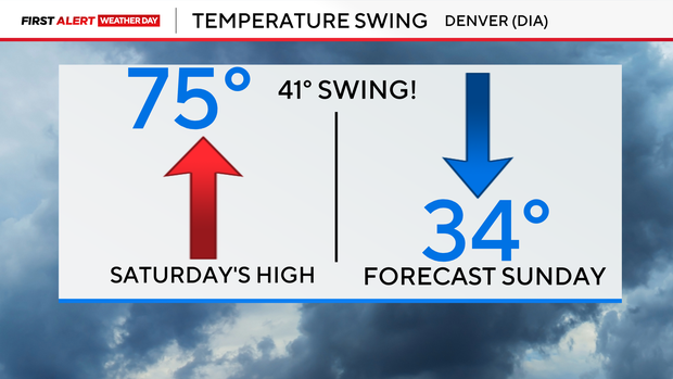
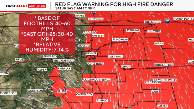
Warm, dry and windy weather is creating widespread critical fire danger across the lower elevations of Colorado. Temperatures along the Front Range and eastern plains are expected to climb into the mid to upper 70s, while humidity levels drop as low as 7–14 percent.
At the same time, strong west winds will increase through the day. Sustained winds around 25 to 30 mph are expected with gusts of 40 to 60 mph, especially during the afternoon. Near the foothills, including parts of Boulder County and northern Jefferson County, brief gusts could reach around 70 mph between 1 p.m. and 5 p.m. Saturday evening.
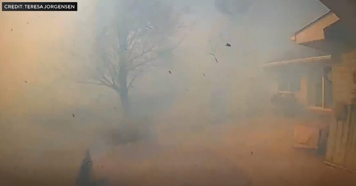
Those conditions dramatically increase the risk of wildfire spread. Any spark could quickly grow out of control, prompting a Red Flag Warning across the Denver metro area and much of eastern Colorado through Saturday evening.
A powerful cold front will sweep across Colorado late Saturday night, rapidly changing the weather. The front is expected to move through the Denver metro area around midnight, bringing a sudden wind shift and a burst of precipitation. Behind the front, north winds could gust between 55 and 65 mph, creating difficult travel conditions overnight and into Sunday. Temperatures will drop quickly below freezing as the system moves through.
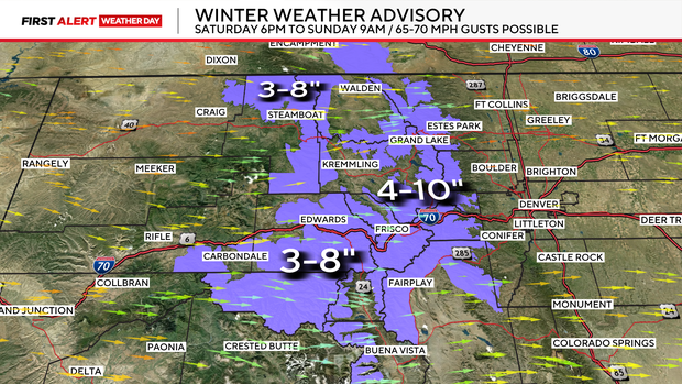
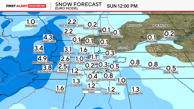
Sunday is another First Alert Weather Day, but for a completely different reason. A quick round of snow is expected overnight into early Sunday morning. Most lower elevation areas, including the Denver metro area, could see a dusting up to about 1 inch, while the Palmer Divide may see 1 to 3 inches.
The bigger story will be the wind and cold. Strong north winds could continue through Sunday afternoon with gusts near 60 mph. Even with daytime sunshine, the cold air and wind will keep temperatures feeling much colder. Wind chills may struggle to climb much above 20 degrees during the day.
After the weekend roller coaster, Colorado's weather quickly shifts again. Winds relax on Monday as high pressure builds over the western United States. That will kick off a rapid warming trend through next weekend.
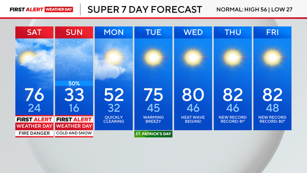
Temperatures could climb well into the 80s across the Front Range, with the potential for record-breaking warmth for mid to late March. However, the return of warm and dry weather could also bring renewed wildfire concerns later in the week.