Denver Weather: More Snow And More Cold Is On The Way
DENVER (CBS4) - Monday will be the fourth day in a row with temperatures staying far below normal in the Denver metro area. The latest reinforcing shot of cold air will also bring more snow to most of the state.
For Denver and the Front Range, most of the snow will wait until Monday night but flurries are possible as early as Monday afternoon. Most neighborhoods around Denver and Boulder will get no more than 1-2 inches of accumulation and areas around Fort Collins and Greeley should get even less.
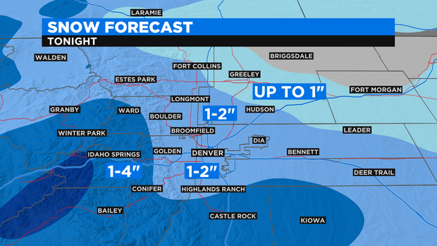
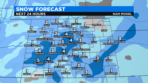
Elsewhere around the state, accumulation will also be limited even in the mountains. Most ski areas will likely get 1-3 inches with isolated higher amounts. Some areas on the Eastern Plains will also get 1-3 inches with the higher amounts south of Interstate 70.
As the storm responsible for this latest round of snow departs Colorado on Tuesday, temperatures will remain chilly. Somewhat warmer weather will arrive for Wednesday and Thursday before another quick chance for snow develops late Thursday night into Friday morning.