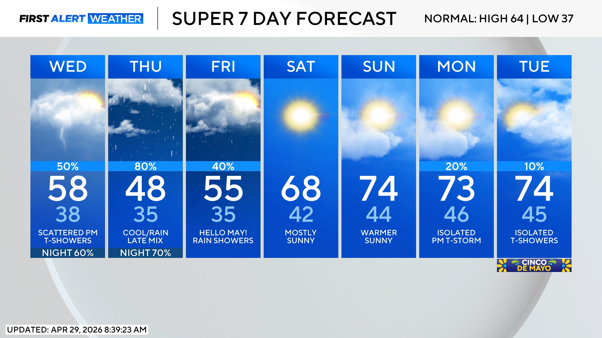
Denver Weather: More rain through Thursday night prompts a rare Flood Watch for the Front Range
Some neighborhoods along the urban corridor and across the plains of Colorado will get more than 1 inch of additional rain through Thursday night. There could be more rain than the ground can handle in some areas which has prompted a Flood Watch through early Friday morning.
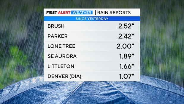
As of 8 a.m. Thursday, some areas had already received at least 2 inches of rain including Lone Tree, Parker, and Brush near Fort Morgan on the Eastern Plains.
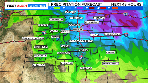
The rain forecast for most of northeast Colorado call for at least another inch of rain and in some cases at least another 2 inches of rain. Excessive runoff from all of this moisture could result in flooding of rivers, creeks, streams, and other low-lying and flood-prone locations. Creeks and streams may rise out of their banks and flooding may occur in poor drainage and urban areas.
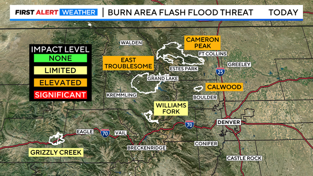
Colorado's burn scars leftover from wildfires in recent years will also be susceptible to flash flooding. The East Troublesome and Cameron Peak scars in particular have an elevated threat for flooding.
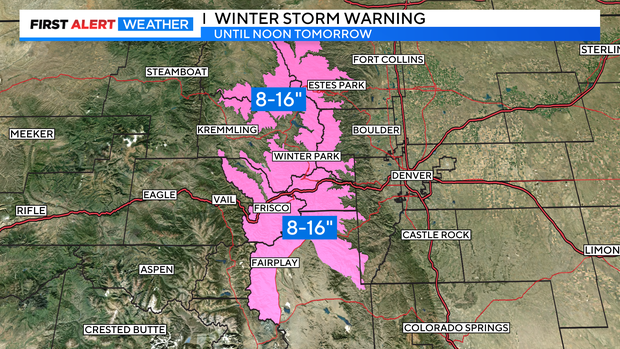
Meanwhile areas above 10,000 will mostly get snow instead of rain through Friday morning. The mountains of Summit County and the Winter Park area are under a Winter Storm Warning through 12 p.m. Friday for 8-16 inches of heavy, wet snow. Plan on winter driving conditions along Interstate 70 above Georgetown and higher mountain passes like Berthoud and Loveland Pass.
Rain (and snow) will finally decrease in intensity and coverage across Colorado by Friday afternoon. Many areas along the Front Range will stay mostly dry through Saturday before chances for showers and thunderstorms increase again for Mother's Day on Sunday.