Denver Weather: Late day severe thunderstorms possible especially east of Interstate 25
After a few days without thunderstorms along the Front Range, the first day of summer on Wednesday will likely include a few late day storms that could be severe.
The thunderstorms are expected to initially develop in the foothills and mountains mostly east of the Continental Divide by 3 p.m. Then the storms will move east across the Denver, Boulder, and Fort Collins areas mostly between 3-7 p.m.
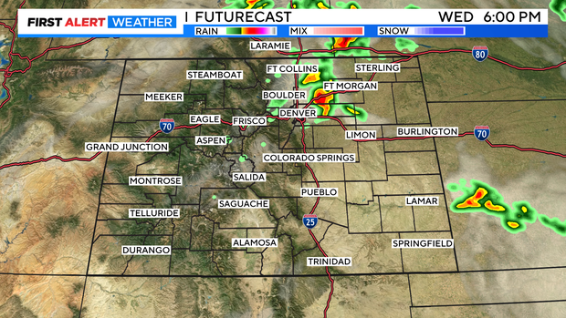
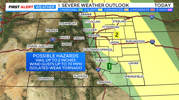
As the storms move east, they will strengthen and some could turn severe. The primary concern late Wednesday is hail that could be up to 2 inches in diameter. Hail that large is more likely to happen somewhere over the Eastern Plains instead of in the Denver metro area. But hail stones large enough to cause damage are possible even along the urban corridor.
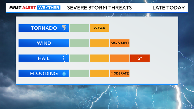
In addition to the threat for hail, storms will be capable of causing wind gusts up to 70 mph and one or two weak tornados could happen in Colorado mainly on the Eastern Plains. Brief heavy rain is also possible but the overall flooding threat is limited.
Most of the thunderstorms will be east of the urban corridor by sunset and the could continue on the Eastern Plains well into the night. Then another round of thunderstorms are expected on Thursday when a few storms could again be severe. Large hail will once again be the primary hazard on Thursday so cover parking is recommended if available!