Denver Weather: After Getting Rocked By Wind, Colorado Has Calmer And Warmer Days Ahead
DENVER (CBS4) - Some areas in Colorado experienced almost hurricane force wind on Wednesday. The storm responsible for the wind will move far enough away on Thursday to allow for a much calmer day.
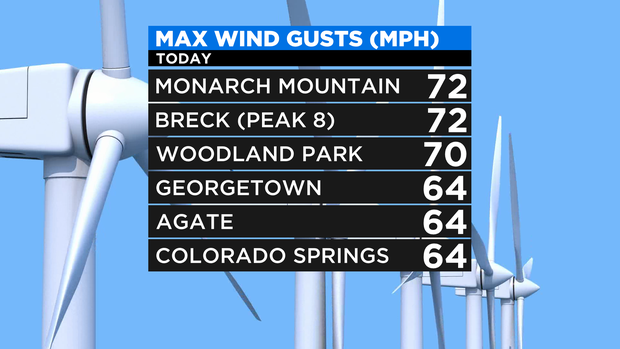
The strongest wind gusts on Wednesday were found on top of mountains like Monarch Pass and Peak 8 at Breckenridge. Woodland Park also had one of the strongest gusts in the state when the wind hit 70 mph Wednesday afternoon.
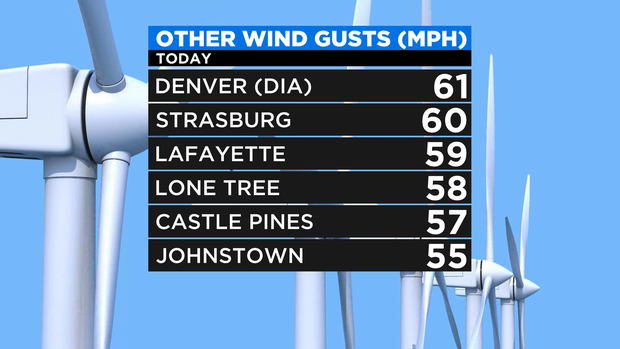
Closer to the Denver metro area, DIA clocked a wind gust of 61 mph, and communities like Strasburg, Lafayette, Lone Tree, Castle Pines, and Johnstown all had maximum wind gusts of at least 55 mph.
Starting Thursday, the wind will be much lighter as high pressure moves from California to Colorado. The new weather pattern will bring the warmest weather of the year to many areas in the state including Denver. The warmest temperature in the city so far this year is 74 degrees on March 2.
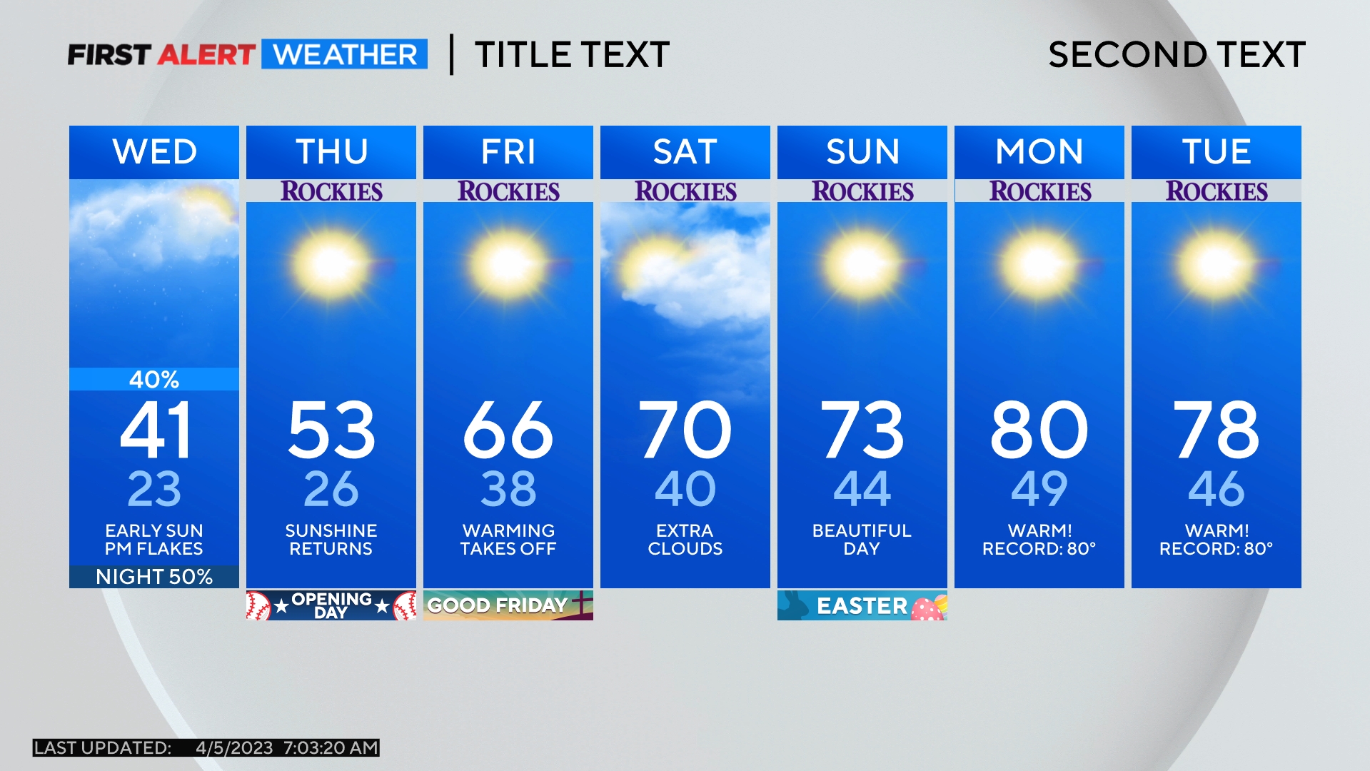
For Thursday, plan on mostly sunny skies, relatively light wind, and high temperatures in the 60s for Denver and the Front Range.
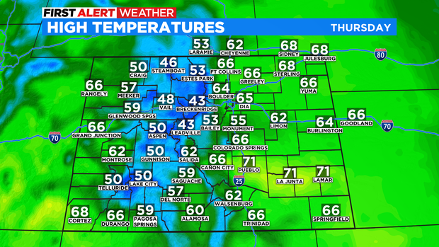
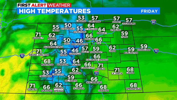
On Friday, a few areas on the Western Slope including Grand Junction will reach at least 70 degrees while the urban corridor and most of the Eastern Plains stay in the 60s.
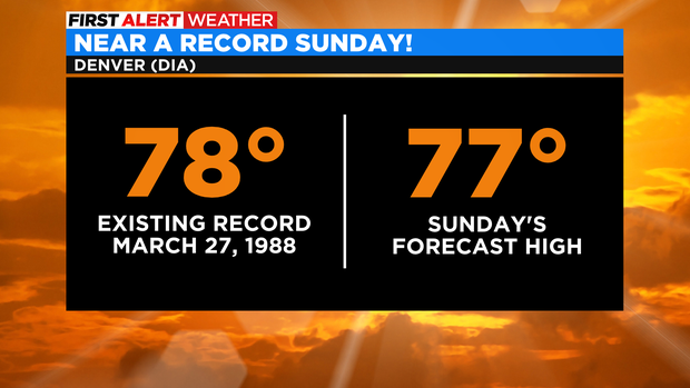
Then the 70s will reach Denver and the Front Range for Saturday, Sunday, and Monday. Denver has the best chance of tying a record on Sunday. The current record high temperature for March 27 is 78 degrees set in 1988. The current forecast is 77 degrees.
Then plan on one more warm day for Monday before the weather pattern changes Monday night into Tuesday. The mountains will eventually get snow next week and the plains should have at least a chance for rain showers. Regardless of precipitation, it will be much cooler for most of next week compared to the weekend.