Denver Weather: Midweek Snowstorm Surging Through
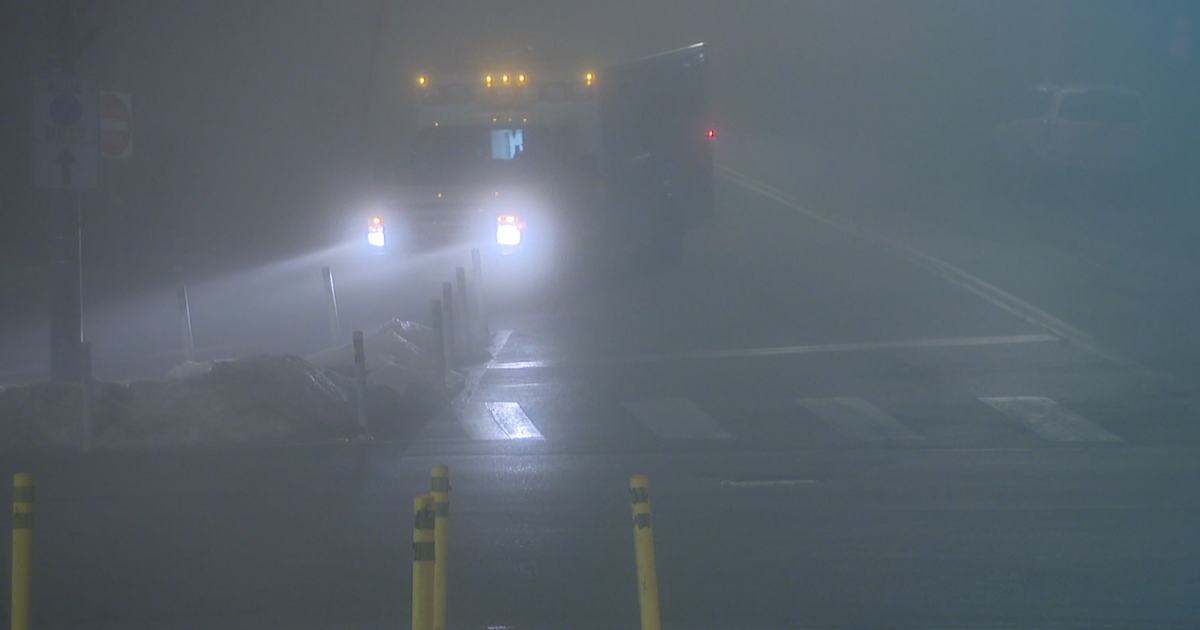
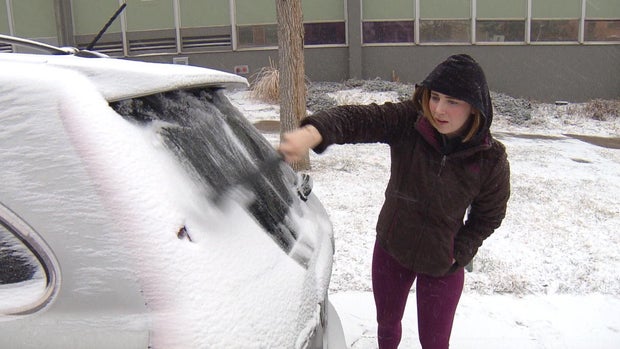
Denver (CBS)- Our mid-week snowstorm is really bogging down most of the roadways for Wednesday afternoon. Several school districts are cancelling after school activities and some businesses released workers early for safety issues related to the slick conditions.
SECTION: Colorado School Closings
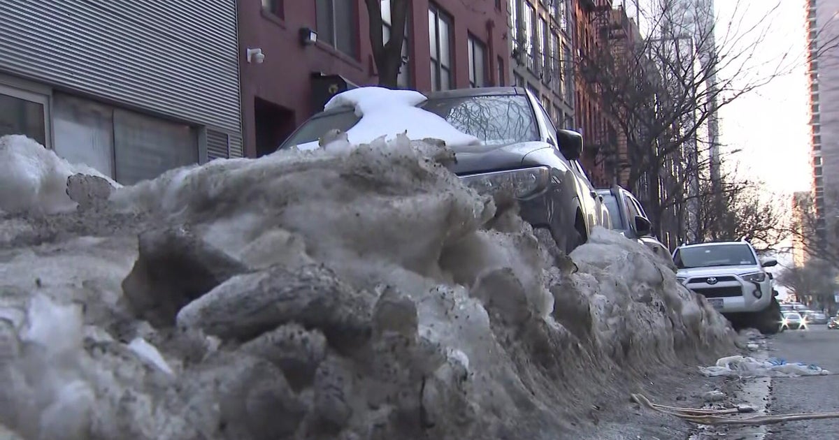
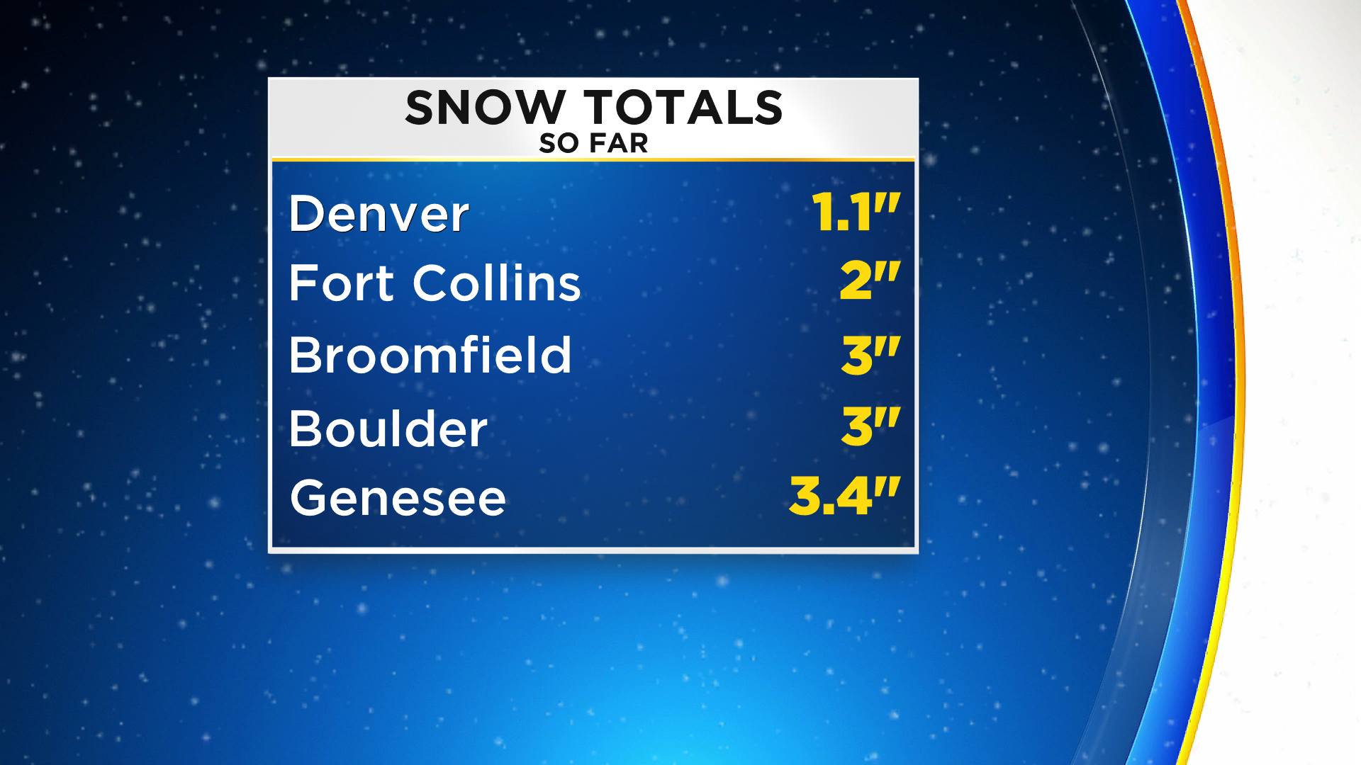
So far, snow amounts have added up to several inches for many areas.
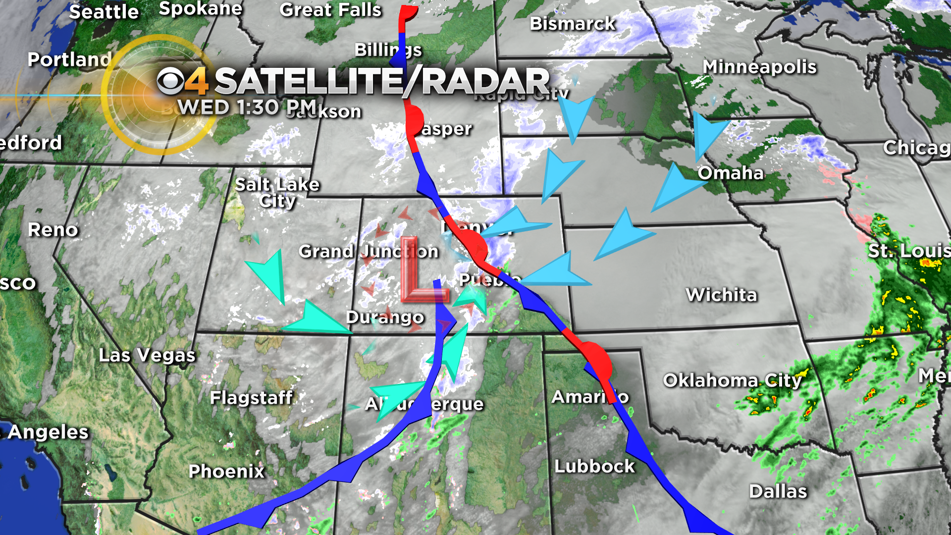
Two weather system have meshed together across the Front Range to fire up bands of heavy snow for the greater Denver metro area. This will lead to a very, slow and slippery Wednesday afternoon commute. Shallow cold air oozed into the northeastern part of the state Wednesday morning laying down a layer of freezing drizzle, fog and light snow.
Later around the noon hour the big California storm system spun into the eastern plains overrunning the cold air. This produces bands of periodic heavy snow to light snow by afternoon.
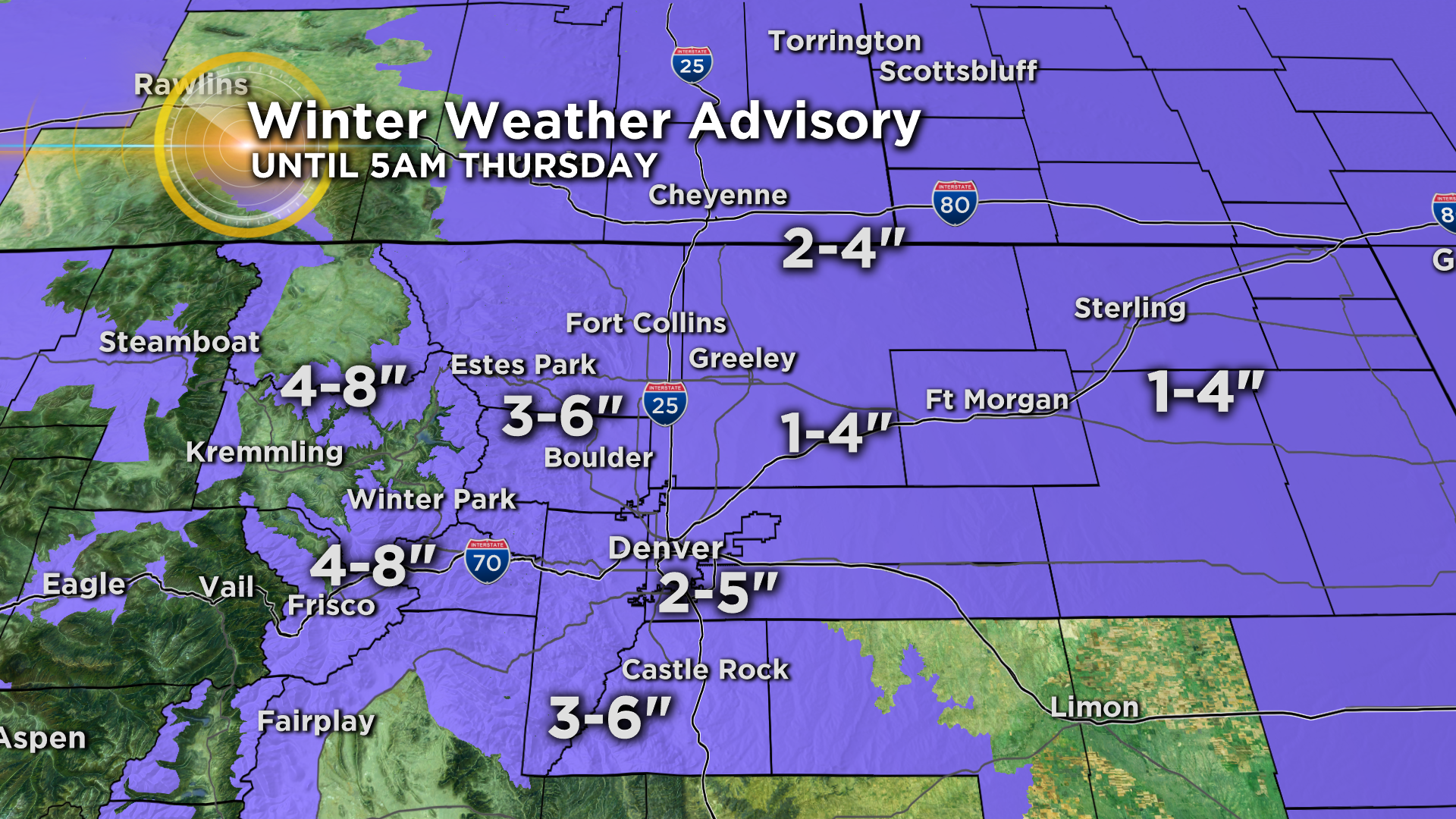
There is a Winter Weather Advisory still in place across the Front Range Denver and most of northeastern Colorado. Denver should see 2 to 5 inches of snow by Wednesday evening. With higher amounts in and near the foothills.
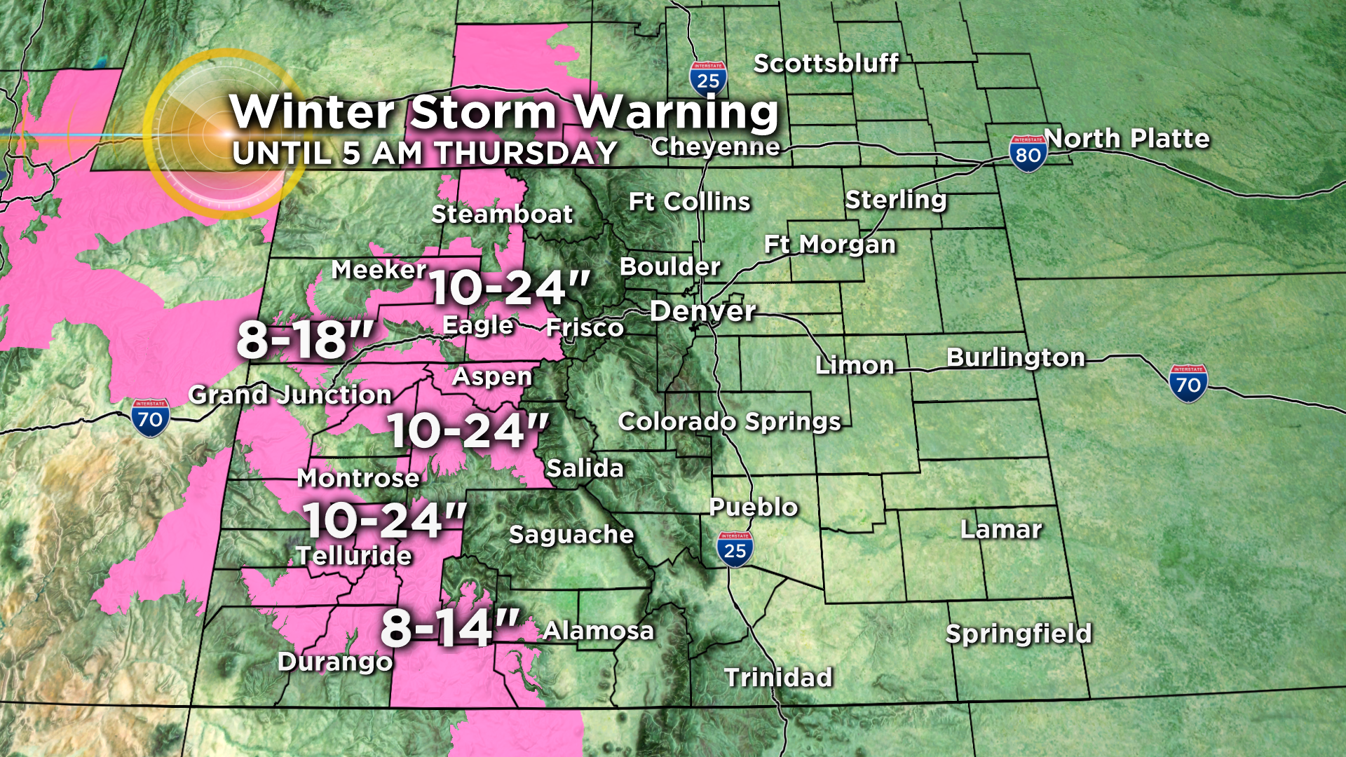
Huge snowfall totals are expected in all of the western mountains from the high country around Steamboat all the way south to Telluride. Many of these mountain zones may see 1 to 2 feet of snow by Thursday morning!
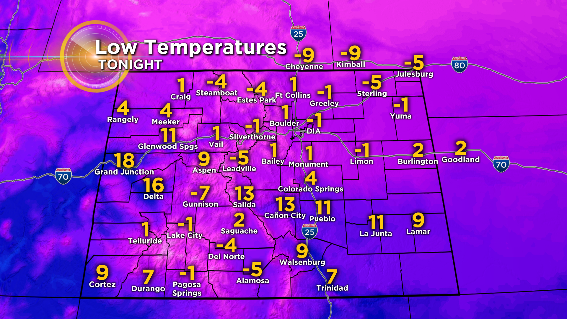
Snow should begin to taper off Wednesday night for most areas of the state. Then, with gradual clearing skies overnight Thursday morning will be cloudy, foggy and very cold! Low temps across the eastern plains will drop into the single digits and below zero! Including Denver and our surrounding suburbs.
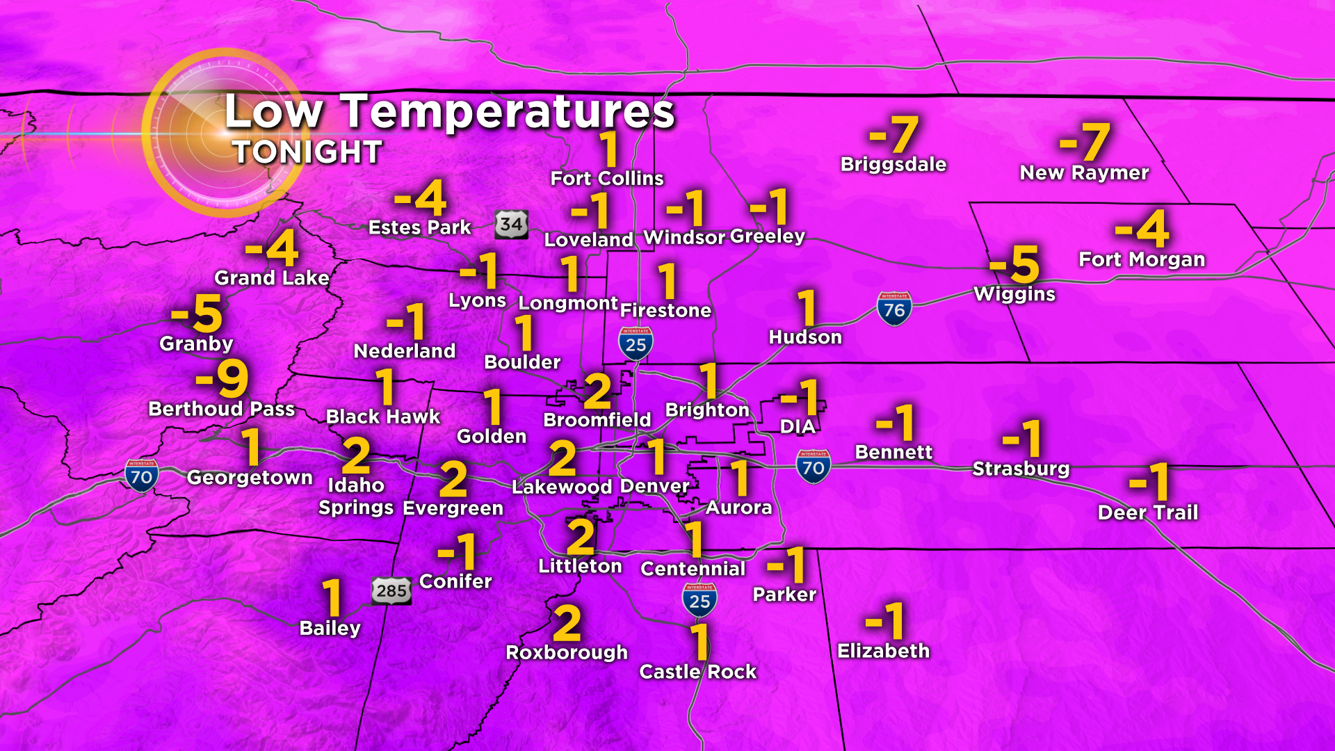
Statewide lows will be bitter cold Wednesday night into Thursday morning as well.
CBS4 has partnered with the Denver Rescue Mission to Spread the Warmth this winter. We're bringing the community together for Coloradans experiencing homelessness. Find out how to help at CBSDenver.com/SpreadtheWarmth/.