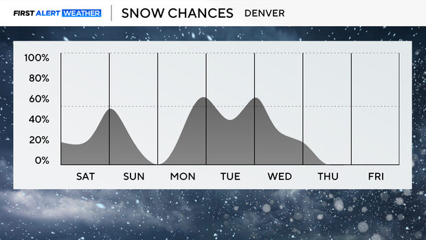
In the next week, Denver has several different chances for snow


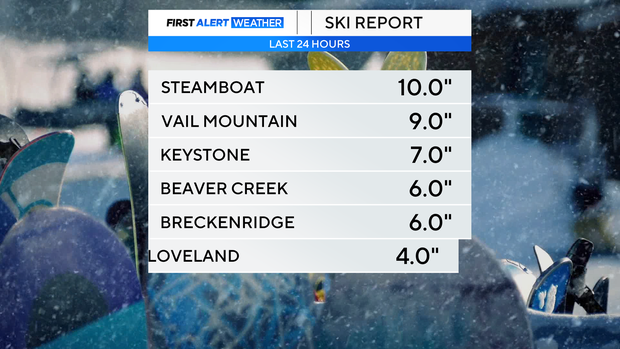
A stretch of snow and cold is returning to Colorado, winter is back. Friday night into Saturday morning some mountain locations picked up close to a foot of fresh powder.
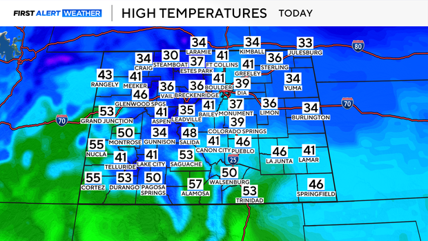
It has been a mild and windy week in Denver with highs in the 60s at times throughout the week. Big changes are headed our way this weekend with colder temperatures and snow back in the forecast. Saturday highs will be in the 30s and 40s along the I-25 corridor.
The general trend will be snow chances each night through Wednesday. Another round of snow moves through Saturday night into Sunday morning. The snow will be light with most locations seeing a dusting to an inch of accumulation. The snow should clear by early Sunday morning. Monday, Tuesday and Wednesday we have a chance for more snow in the forecast. Light snow is expected Monday night into Tuesday morning. Only light accumulation is expected, 1-2" with heavier snow showers possible Tuesday night into Wednesday morning.
Cold front brings frigid temperatures on Tuesday
If the snow is not enough for you, a reinforcing shot of cold air arrives Tuesday keeping highs in the teens and 20s with lows in the single digits. As of now the First Alert Weather Team is forecasting 20 degrees as the high on both Tuesday and Wednesday in Denver. Tuesday and Wednesday will be potential First Alert Weather Days because of the snow and the cold.
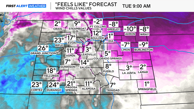
I've attached a wind chill map, aka how the air feels on our skin. It is likely portions of the Eastern Plains dip as low as -15 degree wind chills. The Denver metro area will likely hover around the 0 degree mark at times. This is not abnormal for winters in Colorado, but after spending the week with temperatures in the 60s it is important to be prepared for this shot of cold air.


