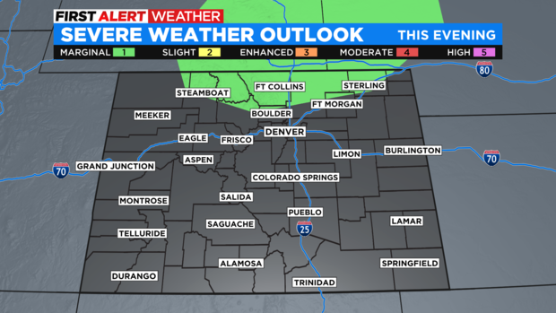
Higher storm chances will bring a flash flood threat over the next few days
After several hot and relatively dry days around Colorado we'll see a welcomed change as we start off a new week. Another surge of monsoon moisture will help generate widespread showers and thunderstorms over the next few days.
With relatively light upper-level winds over the state, thunderstorms will move slowly, and that will elevate the risk of flash floods. Today we're most concerned with area burn scars. On Monday we'll expand the threat into the Denver metro and the Interstate 25 urban corridor.
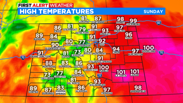
Today should be the last really hot day around the state with widespread 80s and 90s. Some low 100s are possible on the plains. Starting Monday some cooler air will move into the state. Most of the week ahead will be in the 70s and 80s around Colorado.
A few thunderstorms this afternoon could get on the strong side in northern Colorado. That means some wind gusts to 60 mph and hail up to one inch in diameter will be possible.
After the approaching surge of monsoon moisture moves out we'll see drier conditions for the middle of the week. Storm chances won't go away entirely, but afternoon storms will be more isolated in nature. The upcoming weekend could feature another surge of monsoon storms but that is still several days away and the forecast details are less certain at this point.