Cool Wednesday with rain, snow likely through the end of the week

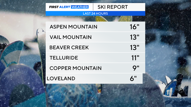
Snow hit the mountain hard Tuesday with some locations picking up more than a foot of fresh powder in the last 24 hours.
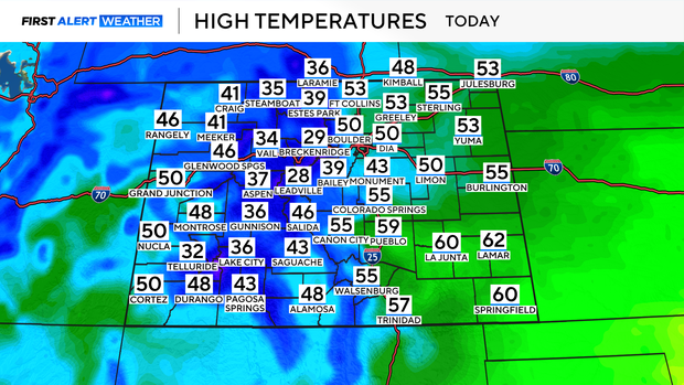
Wednesday temperatures will climb to the upper 40s and low 50s across the Front Range. It will be breezy with the chance for flurries this afternoon. No accumulation is expected today in the Denver metro area.
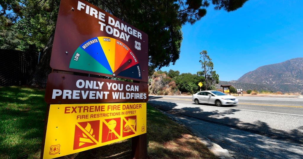
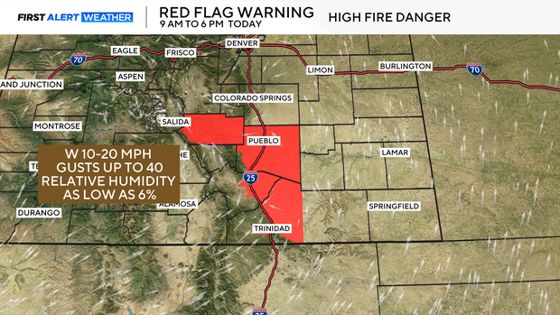
With the windy and dry conditions to the south, a Red Flag Warning has been issued for high fire danger through this evening.
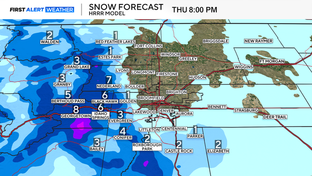
Thursday is a First Alert Weather day for snow and colder temperatures. 2 to 6 inches of accumulation is possible in the mountains with a trace to 2 inches for the Denver metro area. Daytime highs will also be cooler, staying in the 30s.
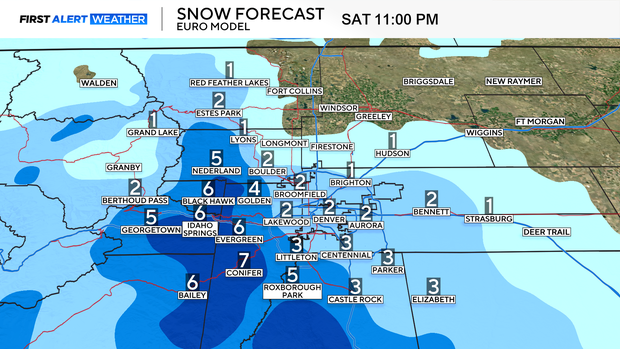
By the end of the work week, another round of snow arrives that's why we have issued First Alert Weather days for Friday and Saturday. For the Front Range 2 to 5 inches of slushy, spring snow is possible. Temperatures will stay on the cool side Rriday and Saturday in the 30s and low 40s.
By Sunday, drier conditions return with highs back in the upper 40s. Next week, we are looking at warmer and drier conditions with daytime highs back in the 60s and 70s.